The North Face Endurance Challenge California

16 Nov 2019 (Sat)

directions_run

10km, 21.10km, 80.47km, 42.20km, 50km, 5km

The North Face Endurance Challenge California

schedule 24h ticket cancellation

local_activity Deals & Discounts

verified_user Refundable Booking

Join The North Face Endurance Challenge California

The Golden Gate National Recreation Area (GGNRA) is one of the world’s largest urban national parks. The combined sites that make up the park lure both locals and visitors from around the world to some of the best historical sites, beaches and hiking trails in the country. Better yet, all are within easy reach of San Francisco, so day hikes can be combined with a night out on the town or return to that comfy hotel room. With that being said, the North Face Endurance Challenge Half Marathon is the place to be.

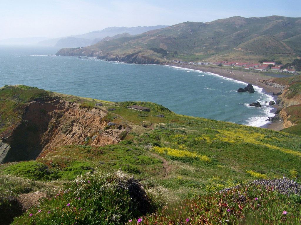
Located in the visually stunning Marin Headlands, The North Face Endurance Challenge Championship course engages runners with both scenic views and drastic elevation change.

Set to take place in the stunningly gorgeous — and very hilly and challenging — Golden Gate National Recreation Area just across the Golden Gate Bridge from San Francisco, the North Face Endurance Challenge features a weekend filled with a variety of race distances.

While full of scenic views and gorgeous trails, this course is not for the unprepared. The course terrain combines fast-paced dirt trail with portions of technical single track overlooking the Pacific Ocean with occasional glimpses of the Golden Gate Bridge. Runners should prepare for repeated elevation gains and losses of several hundred feet.

Course highlights

Runners will begin at the Marin Headlands Visitors Centres and take Bunker Road out of the main event site. The course then takes a fireroad until it reaches the first trailhead area that connects to the Miwok Trail.

After that, runners will take the hill up to Old Springs Trail where they will make a left. Old Springs Trail will be an easy descent at first and then turn into switchbacks. At the bottom of the hill, runners will pass through the Miwok Livery Stable and to the first aid station at Tennessee Valley.

This first section is tough — with almost 900 feet of elevation to climb right in the beginning.

After leaving the Tennessee Valley aid station, runners will take a paved path that turns into a fire road. The Coastal Fire Road then climbs 400’ in elevation in just a half mile. Once mastering the climb, runners will make a right onto Coyote Ridge Fire Road.

At Fox Trail, runners will make a right and take the trail all the way until reaching the pavement. Once the racers are back on pavement, they will make their way to the Tennessee Valley aid station once again.

Upon exiting the aid station again, the course will follow Marincello to the top of the hill. This next section is just 2.9 miles. Once at the top of the hill, runners will take a left on Bobcat Trail and then a right on Alta Trail. As the course reaches the final aid station at Alta, runners will know they only have 2.8 miles of downhill left.

Once runners exit the Alta aid station, they will take the Rodeo Valley Trail. The course continues along this trail until intersecting with the Coastal Trail. They will make a left and then cross a footbridge which will carry them to the perimeter of the parking lot along Bunker Road.

The final left onto Simmonds Road will be the perfect time to kick to the finish as racers make their way to the finish at Fort Barry.

Read More

Reviews

Terrible star_border
Poor star_border
Ok star_border
Very good star_border
Excellent star_border

Be the first to write a review for this event

The North Face Endurance Challenge California

schedule 24h ticket cancellation

local_activity Deals & Discounts

verified_user Refundable Booking

The race information has been found on the official website of the event or through publicly available sources. Always refer to the official website the latest race information. Please let us know if any data is wrong or missing, by emailing us.