Squamish 50

17 Aug 2024 (Sat)

directions_run

130km, 80.47km, 23km, 50km

Squamish 50

schedule 24h ticket cancellation

local_activity Deals & Discounts

verified_user Refundable Booking

Join Squamish 50

An hour north of Vancouver and another hour to Whistler, Squamish sits at the meeting point of ocean, river and alpine forest. Squamish is a community and a district municipality in the Canadian province of British Columbia, located at the north end of Howe Sound on the Sea to Sky Highway. Squamish’s extensive quality trail system is a key feature of an annual 50 mile ultra trail run, the Squamish 50.

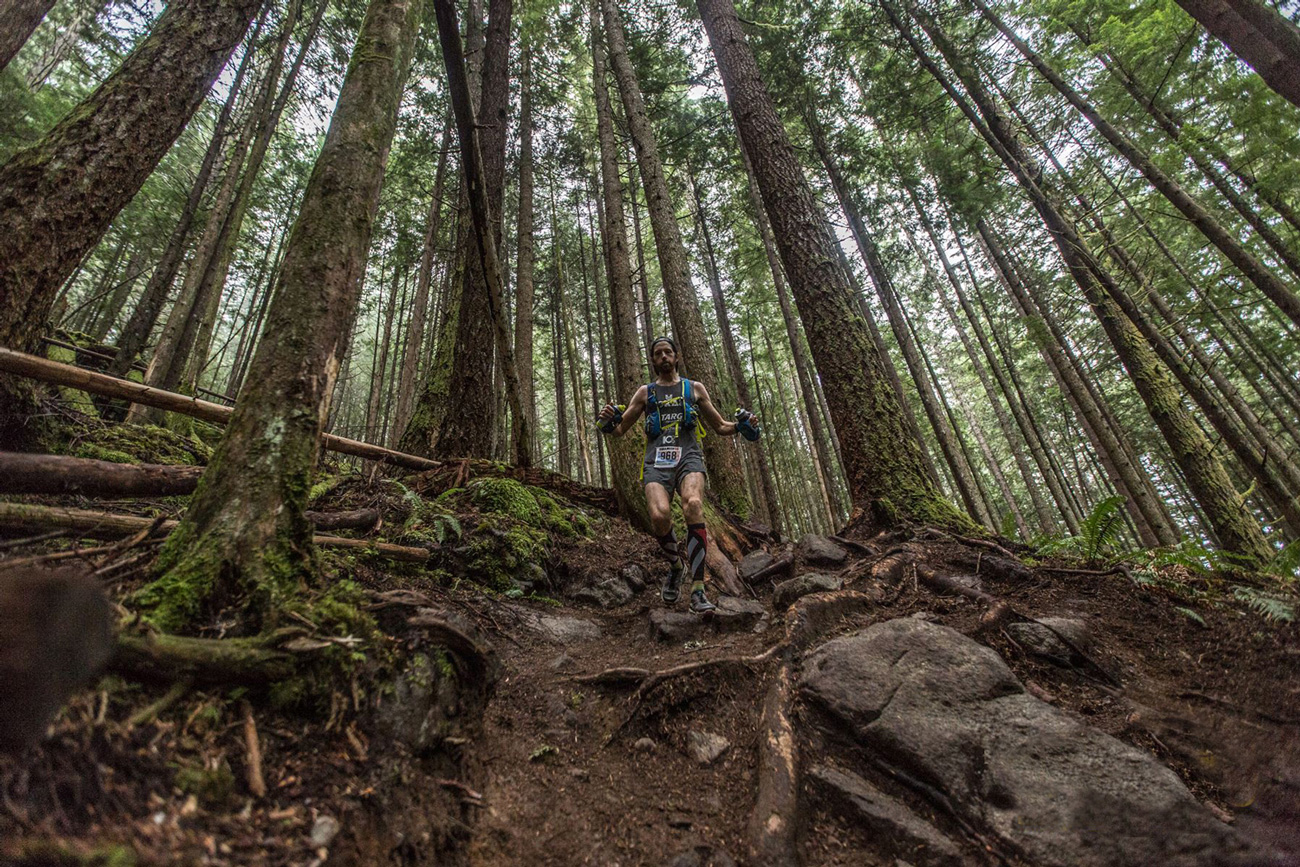
The Squamish 50 mile race is a tough, truly unforgettable trail running experience. This race is a point to point, with no loops. It Starts at Squamish Oceanfront and Finishes at Pavilion Park, Squamish. Between the relatively flat first six miles and final mile, you’ll find over 3350 m /11,000 ft of climbing jammed into the remaining 43 miles of terrain. Your largest individual climb is 760 m / 2500 ft. This is an exceptionally difficult course made tougher still by the technical nature of a majority of the terrain. With much climbing and descent, topped off by stunning sweeping vistas across glaciated snow capped peaks that jut straight out of the Pacific Ocean, this course is sure to take your breath away.

Course highlights

 The world famous Chief looms above and on a clear night it’s nothing but stars and mountains staring down on our starting line.The first seven miles / eleven kilometers are flat, fast and twisty, as you make your way through the heart of Squamish and out to the hills and mountains that’ll dominate the rest of your day. 

After your first aid station you head through a small neighborhood to gain the Coho Trail. Shortly after getting back onto the singletrack at Coho Trail you’ll start towards your first big climb of the day, up and over Debeck’s Hill, which presents about 1000ft / 300 meters in about one mile / 1.5km. As you ascend Debeck’s you’ll be confronted with some of the steepest terrain of the entire race, but you’ll be rewarded with views up valley and out over the mountainous peaks of The Tantalus Range. As you crest the top you’ll test your fancy footwork through some rocky terrain before it peters out into a 4×4 service road. On the way down you’ll pass by a historic Steam Donkey forestry relic.

You swing back onto singletrack after just a kilometer or so of service road, and then drop down a trail named Mid-life Crisis to intersect with Jack’s Trail. Once you pop out onto Jack’s it’s flat and fast all the way to your second aid station at Alice Lake. There are flushable pit toilets to utilize if breakfast hasn’t been sitting well. Enjoy the feast of the aid station and proceed through Alice Lake Park to gain Four Lake Trail at the far side of the campgrounds.

You will first run past Stump Lake and then Fawn Lake before popping out onto the Bob Macintosh Trail. Turning left we head towards Dead End Loop, stay left on Dead End Loop to tackle your first sizeable climb up Made In The Shade to gain Ed’s Bypass. Drop back down to Rob’s Corners and enjoy the winding flowy slight downhill grade.

Your third aid station, and first drop bag location, will be located in between Rob’s and Cliff’s Corners. As a 50 mile runner you’ll be turning right to complete a 10km loop via Cliff’s Corners and one of your RD’s favorite trails, Entrails. This 10km loop is a mix of runnable and not so runnable for those unfamiliar with technical terrain. Once you drop down Entrails you return to the same aid station for a second time, via a very runnable double wide trail / gravel surface decommissioned road. Check back in at the aid station a second time, use your drop bag again, and then exit the aid station the opposite direction you did the first time.

You’re now on the Northside Connector gravel service road for a few kilometer, enjoy the last bits of runnable terrain before you head into the big nasty. Stay right at the Y split in the Forest Service Road, proceed approximately 1 km further until you can pick up a trail on your left named Plastic Scheisse. This trail is located just a few hundred meters after you cross over a prominent water flow in the FSR.

Plastic Scheisse climbs to Galactic Scheisse and tops out at over 3300 feet. Given that your starting line is approximately 600 feet and you’ve only gained a minimal total amount up until this point in time you should ensure you’ve grabbed ample supplies from your last aid station. The trail climbs at a steady grade that is indeed runnable by those challenging near the front. The total gain is over 2500 feet and it plays out over approximately 4 km of continued ascent. 

Nearing the top there are a few minor water crossings. There is a slight reprieve once you top out but shortly thereafter you are thrust into an equivalent descent. Trails you’ll run include Upper Powersmart, IMBA Smart, Fred, and Word Of Mouth. The trails will start off as average technical and proceed into greater technicality as your legs begin to bare more fatigue. 

As you exit Fred you’ll arrive at your second aid station of the day. Given that this is relatively close to Quest University this aid station will only be stocked with water, coke and gel. Once you exit Word Of Mouth you’ll be at the approximate 30 mile point of your race at Quest University. A full aid station, full facilities and your other drop bag awaits.

Once you depart Quest it’s back to the climbing again. This time via Garibaldi, to The Climb Trail. Early in The Climb Trail you’ll pass a beautiful little waterfall and about a mile further along you’ll start to get some more open views back down valley towards Quest and across to The Tantalus Mountain Range. You are climbing on singletrack until crossing over The Northside Connector before linking up with the newly completed Upper Climb Trail. Climbing, climbing, climbing you’ll top out as you find A.M. or the non politically correct name of Angry Midget. 

At the bottom of A.M. cut left onto Ring Creek and follow it for a few hundred meters until you can cross over the Garibaldi FSR. You will access another aid station here. Once across the gravel road you’ll drop back onto singletrack. This will wind you down to a river crossing while using the ‘Darwin’s Bridge’. A short but steep climb awaits you on the other side and you’ll be taking your first right onto STP. From here to the finish you’ll be following the same course as every other distance.

You get to drop down STP, climb back up on Bonsai, drop back down on Somewhere Over There, and then hit your final aid station of the day at the entrance to The Far Side. Turn onto Fartherside and then S&M Connector. 

Crossing under the powerlines you take a left onto Endo but only briefly before you turn right onto Seven Stitches as you slowly climb up to Pipe Trail. From Pipe Trail you are closing in on your final climb of the day, up Mountain Of Phlegm. From the top of Mountain Of Phlegm, which is a short but steep climb, it’s ‘almost’ all downhill to your finish line.

Take Summer’s Eve into The Smoke Bluffs, blaze past the rock climbers and boulderers until you end up in the parking lot down below. It’s time to get those legs to turn over on some flat stuff finally, and you’re only a few kilometers from celebrating your achievement in our beer gardens. Along the water, through Rose’s Garden, under the highway and down to Pavilion Park where you can finally lay down and call it a day.

Read More

Reviews

Terrible star_border
Poor star_border
Ok star_border
Very good star_border
Excellent star_border

Be the first to write a review for this event

Squamish 50

schedule 24h ticket cancellation

local_activity Deals & Discounts

verified_user Refundable Booking

The race information has been found on the official website of the event or through publicly available sources. Always refer to the official website the latest race information. Please let us know if any data is wrong or missing, by emailing us.