Georgia Jewel
15 set 2023 (Fri)
160,93km, 80,47km, 56,33km, 28,97km


Join Georgia Jewel
The Georgia Jewel is Georgia’s longest standing 100 mile endurance race. Created from a passion for the trails and running, the Jewel surpassed all odds and quickly became a favorite among the ultra community. Never before had a running event hosted on the GA section of the Pinhoti thrived, or for that matter, lasted. But with strong ties to the local community and a deep desire to give back to the trails that so graciously gave to runners, the Jewel rooted itself to the Pinhoti.
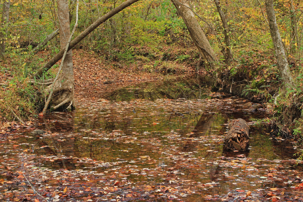
The Georgia Jewel 100 is an out and back race, run on the pristine Georgia Pinhoti trail. This rugged course on North West Georgia’s Pinhoti Trail will escort you across five scenic mountains and along the narrow crests of several ridges of the Chattahoochee National Forest. This mostly single track trail is technically rocky and rooty but is well maintained by our friends at NWGA SORBA. There are several stream crossings to be experienced during the race. The lowest elevation on the course is 770 feet and the highest elevation of 1788 feet will reveal the views from the top of Dug Mountain. Because of the out and back nature of the course, runners will both climb 16,053 feet and descend 16,053 feet during the 100 mile distance. The course consists of roughly 70 miles of single track trail, 21.5 miles of jeep road and 8.5 miles of paved road. Tenacity will allow you a final downhill finish to a unique award for your ultra-achievement.
Course highlights
The race will start and finish at the Dalton Convention Center. The 1st mile is on paved road as you slowly climb 1.3 miles to the Fire Service road gate of the Dug Gap Trailhead. You’ll continue climbing on the FS road reaching the top of Dug Mountain by mile 2. You’ll then jump onto the single track trail on your left and proceed along the Dug Mountain ridge line. This ridge line, while offering some great views, will also earn a place in your memory as ‘the rock garden’. About mile 5 you will come off of the Dug Mountain ridge and cross Hurricane Valley. About Mile 5.5 the trail T’s and you go to the left reaching unmanned water stop # 1 within a 100 yards. By mile 6 you will have reached the top of Hurricane Mountain and by mile 7 you will have views from the top of Middle Mountain.
You’ll proceed along the Middle Mountain ridge line until coming to the Stover Road aid station at mile 10. Here the trail intersects a FS road that you make a right turn on to. You’ll now make your way down into a valley. Before you leave the valley, just after mile 12, you’ll run beside a small creek that provides four rock hopping crossings.
The other side of the valley you’ll climb for about one mile before reaching the top of Mill Creek Mountain. You’ll then travel the wavy Mill Creek ridgeline for about 2.5 miles. You’ll finally have a mile plus downhill with some switchbacks before arriving into the Snake Creek Gap aid station at 17.2 miles. Refuel, refresh and cross the road at the parking lot entrance to continue onto the trail directly across Road 136.
You’ll spend the next mile climbing Horn Mountain and the following mile running along it’s ridgeline. By mile 20 you’ll begin a gentle downgrade that will meander through a thinly treed forest with dappled sunlight. About mile 21 the trail will curve and dip to the right bringing you to unmanned water stop # 2. A Pinhoti sign points both straight and to the left. You go left and will come to a sign for Pilcher’s Pond. You’ll enjoy this pretty section of trail passing the pond and all the way down to the Pocket Road. You should have reached Pocket Road via FS # 356.
Crossing Pocket Road you’ll go left (south) just 1/10 of a mile and turn right into FS road # 702. About 0.6 miles up this FS road it will return to Pinhoti single track for just hikers and runners. There are public restroom facilities here. You’re going to be climbing up the southern side of John’s Mountain. At about 23.5 miles you’ll have some densely forested scenic overlooks to your left. Another half mile you’ll be ascending steep rough hewn stone steps toward the Keown Falls overlook deck. Continuing past the deck the trail T’s and you want to go right. Only about a 0.8 mile climb to your turnaround point. It’s a small clearing with a gravel parking lot and your aid station at the viewing deck. Refill your fluids and grab some fuel. Before setting off for your trek into the valley beneath the viewing deck, take just a moment to appreciate the view that your hard work has presented you. Well done.
Leaving John’s Mountain aid station you will travel down the gravel road on the north side of the mountain for about 0.6 of a mile. Watch for a Pinhoti trail sign on your left that will deliver you back onto dirt single track. You’ll spend the next 2 miles rounding John’s Mountain staying about 500 feet from the top all the way around on gently rolling single track trail. The next 2 miles will slowly take you to the bottom of the mountain and a creek crossing. The near creek side is unmanned water stop # 3. Crossing the creek you’ll proceed on the fire service road about 0.1 of a mile and the trailhead sign will be on your left. Follow the trail to a gravel road and follow the signage to the left. Within a ½ mile you’ll come to a fork in the road, take the right hand fork away from the creek. Just 0.1 mile further and the single track trail head will be on your right. You’ll follow this for another mile to the E. Armuchee Road trail head. This is 32.9 miles into your run. This trail head was previously the E. Armuchee Aid Station. We have moved this aid station about 1.5 miles further south to make this aid station more equi-distant between John’s Mouintain and Narrow’s Road Aid Stations.
Leaving the E. Armuchee Trail head you’ll turn left onto E. Armuchee Road. You’ll only be on E. Armuchee for about 0.3 mile and then turn right onto Manning Road. About 0.8 miles down Manning Road, the Pinhoti trail will turn left. It’s a dirt road with a FS # 227 sign. It’s only about 0.2 of a mile to a creek crossing. There is a bed of concrete planks that makes the water just a few inches deep but they can be slippery, so tread carefully. After crossing the creek you’ll come to a clearing on the left. This is the new Manning Road Aid Station location. If you want to put on dry socks or shoes, you’ll probably not get your feet wet again until your homebound trip back through here.
Leaving the Manning Road Aid Station you’ll continue to your left across this clearing and look for the single track to continue. You’ll climb for the next mile and end up on a ridge with some great views out to the left. You’ll continue on this ridge for 2 miles and then slowly work your way down to W. Armuchee road at about mile 36.
You’ll turn left onto W. Armuchee and proceed only about 0.3 miles to Narrows Road on the right. You’ll follow the paved section of Narrows for about 2 miles. Shortly after the paved section ends, the Narrows trail head and aid station will appear on your right at about mile 38.After about 1 mile on single track trail you will again be on the gravel road. Turn right onto the road and proceed 0.4 to a fire service road on the left. Proceed down the fire service road about 2/10s of a mile to the single track trail on the right. You’ll spend about a mile climbing to the top of a ridge and then another mile running it. You’ll come to a grassy clearing with a road going in both directions. Turn to the right and follow the gravel road. You’ll follow the road for about 3 miles with gentle ups and downs.
At approximately mile 46.6 you’ll reach unmanned water stop # 4. Only 5.0 miles to the Mack White aid station. Continue about 1.5 miles around a metal gate and into a circular clearing. You’ll go straight across and continue down fire service road # 254 about 2 miles. Then you'll turn right and up the powerline road. Watch out for the ruts on the 1st two hills. The power lines will take about 0.8 mile to traverse. About 2/3 of the way up the 5th hill you'll again intersect the Pinhoti trail. Make a left and proceed approximately 0.3 mile down hill towards the Mack White Aid Station. Refuel and start back knowing that you are half way home.
Recensioni
Puoi essere il primo a scrivere una recensione per questo evento
Le informazioni sulla gara provengono dal sito ufficiale dell'evento o da fonti pubblicamente reperibili. Consulta sempre il sito web ufficiale per le ultime informazioni sulla gara. Informaci tramite email. se alcuni dati sono errati o mancanti.