Orcas Island 50K


Join Orcas Island 50K
Orcas Island is the largest of the San Juan Islands, which are located in the northwestern corner of Washington state in San Juan County, Washington, United States. Mount Constitution (elevation 2409 feet – 734 meters) is the highest point in the San Juan islands. The mountain is part of Moran State Park, the largest public recreation area in the San Juan Islands. Moran State Park encompasses over 5,000 acres (2,000 ha) of woodland and has several lakes and numerous waterfalls. The park was given to the Island.
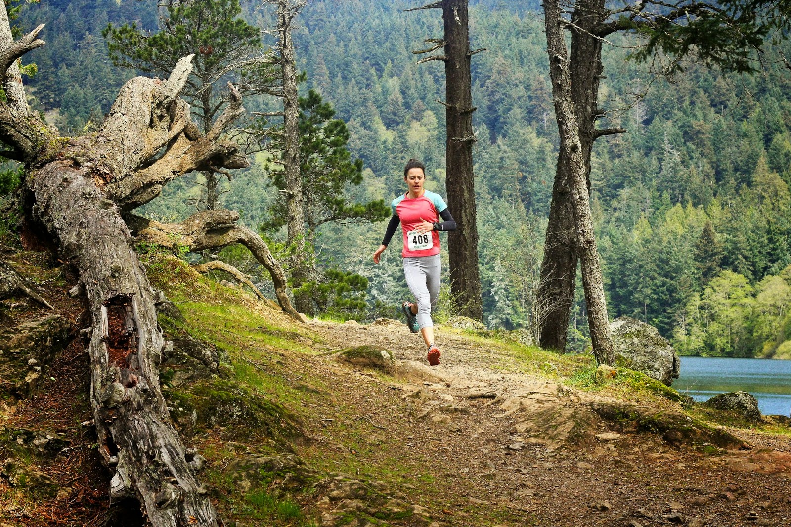
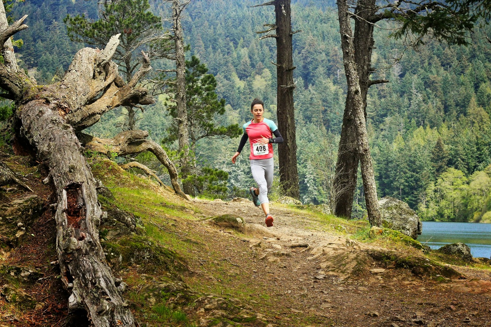
The Orcas Island 50k is unique in the trail running world, with old-growth forests, tough climbs, and spectacular views of surrounding islands, mountains, and Puget Sound, but what truly sets it apart is the chance to hang out all weekend on a gorgeous island with your trail runner friends. These are the oldest of all the Rainshadow running races. Races that will leave you wondering: Why run anywhere else?
Course highlights
START: CAMP MORAN
0.0 Head downhill on dirt road just south of Camp Moran
0.1 Turn right onto paved road
0.2 Turn right onto Olga Rd
0.3 Turn left onto Cascade Lake Trail
0.4 Turn right onto trail to Cascade Falls
1.0 Cross paved road and go down trail at far side of parking lot towards Cascade Falls
1.1 Turn left towards Mountain Lake
1.6 Turn right onto dirt road
1.8 Turn left onto trail towards Mountain Lake
2.5 Turn left and go across the bridge just below the dam
2.9 Turn left onto Mountain Lake Rd
3.0 Turn right onto Mt Constitution Rd
5.0 Turn right onto Little Summit Trail
5.3 Turn right and head down towards Mountain Lake
6.4 Aid Station #1 Mountain Landing - get on Mountain Lake Trail headed counter-clockwise
6.7 Stay left at intersection
7.0 Cross the bridge below the dam and immediately turn left to continue following the Mountain Lake Trail
7.1 Stay left and on the trail at an intersection with a dirt road
9.0 Turn right towards Twin Lakes and Mt Constitution
9.8 Make a slight right onto Twin Lakes Trail and follow around both lakes clockwise
10.6 After going almost all the way around both lakes turn left onto Mt Pickett Trail
12.0 Right after the top of Mt Pickett, turn left onto SE Boundary Trail
13.2 Turn right onto unnamed trail
13.8 Turn left onto Mt Pickett Rd (dirt road)
14.6 Aid Station #2 Mt Pickett -- turn left onto unnamed trail
15.5 Turn right onto SE Boundary Trail
16.8 Turn left to stay on SE Boundary Trail
17.5 Turn left onto Mt Pickett Rd
17.9 Turn left onto SE Boundary Tr
18.5 Turn right onto trail to Cascade Falls
18.6 After crossing below the falls and climbing up the stairs, make an immediate left and head downhill
18.8 Cross Olga Rd (paved road) by the South Arch and continue down the SE Boundary Trail
19.0 Turn left to stay on SE Boundary Trail
19.5 At intersection with Sunrise Rock Trail, turn right to stay on SE Boundary Trail towards Cascade Lake
19.6 Turn left onto Cascade Lake Trail and follow the lake trail clockwise around the lake
20.2 Turn right and cross bridge. Stay right at the next three intersections
20.5 Turn left onto unnamed trail to North Arch pay station
20.6 Aid Station #3 North Arch -- from the pay station, cross Olga Rd(paved road) and get on the West Boundary Trail(aka Powerline Trail).
22.7 Turn left onto North Boundary Trail
24.7 Turn right onto the trail to the top of Mt Constitution
25.8 Turn left onto the paved road of the Mt Constitution parking area. As you make your way into/through the parking lot, look for the trail going up to the historic Mt Constitution Tower.
25.9 Aid Station #4 Mt Constitution (in case of inclement weather, the aid station will instead be 1.4 miles further down the trail at Cold Spring) -- from the tower jump on the trail by the aid station, following the ridgeline towards Summit Lake and Little Summit.
26.9 Turn right onto Cold Spring Trail
27.1 Cross Mt Constitution Rd (paved road) and continue following Cold Spring Trail
27.2 (In case of inclement weather, this is where Aid Station #4 will be - Cold Spring)
27.7 Stay straight / left to stay on Cold Spring Trail and drop steeply down to Cascade Lake
29.9 At Cascade Lake Day Use Area DON”T CROSS THE ROAD. Instead turn left and follow the Cascade Lake Trail clockwise toward Cascade Falls
30.5 Turn right to stay on Cascade Lake Tr and go downhill
30.6 Cross Olga Rd (paved road) and continue on Cascade Lake Trail
30.7 Turn right onto paved trail
30.8 Turn left onto paved road
30.9 Turn left onto dirt road
31.0 Turn left off the dirt road and drop down into Camp Moran and the Finish line.
Mappa del percorso
directions_runStart address: Moran State Park,us
flagFinish address: Moran State Park,us
Recensioni
Puoi essere il primo a scrivere una recensione per questo evento
Le informazioni sulla gara provengono dal sito ufficiale dell'evento o da fonti pubblicamente reperibili. Consulta sempre il sito web ufficiale per le ultime informazioni sulla gara. Informaci tramite email. se alcuni dati sono errati o mancanti.