Join Endless Shore Ultra Trail
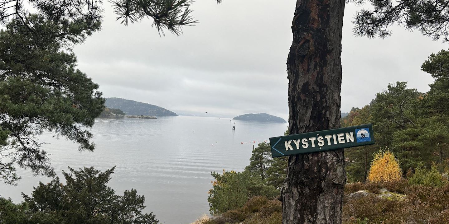
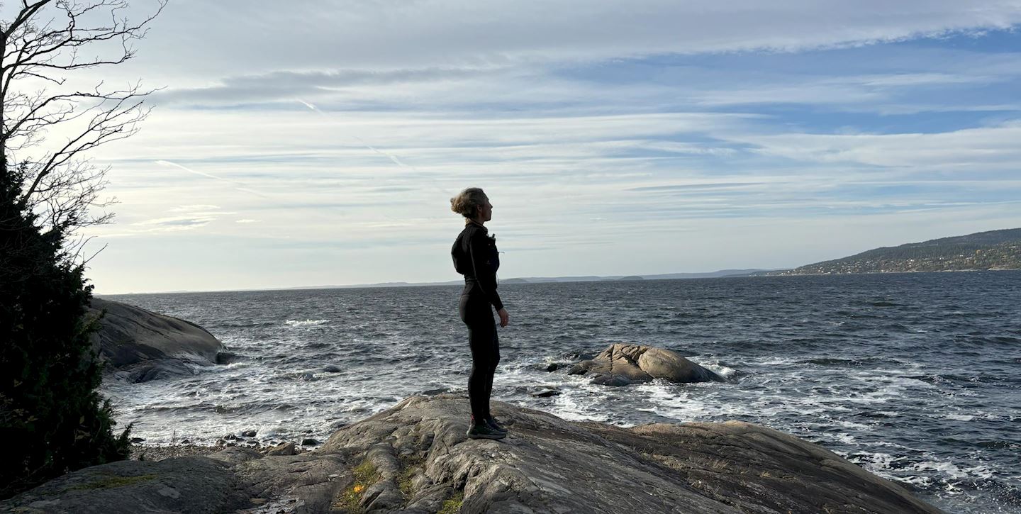
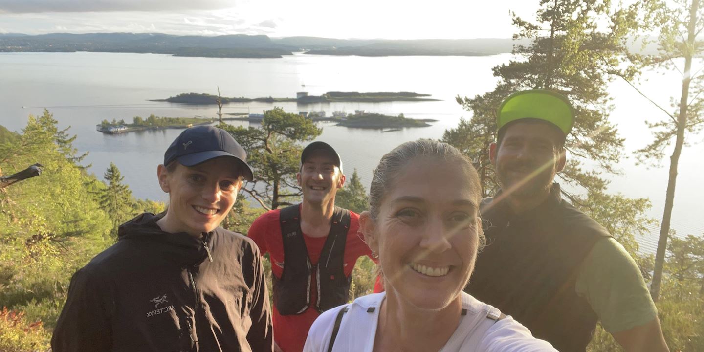
A fun race through beautiful trails along the coast, passing by picturesque villages and pine needle trails. The path follows rocky beaches, wild stretches into the forest and some easy parts into small, idyllic villages. The race ends with a view across the fjord towards Oslo in beautiful surroundings, offering great meals on the way.
We share our favorite trails with you and are thrilled to give you an adventure to remember for the rest of your life!
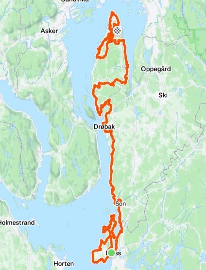
This race follows the coastal path through four municipalities along the Oslofjord, from Moss to Nesodden, mostly on countryside trails with some gravel roads and asphalt. The 100-mile route begins with a loop around Jeløya before heading north, traversing rocky beaches and pine forests through towns like Son, Hvitsten, and Drøbak. The 50-mile race climbs the coastal path directly. After Drøbak, racers encounter Seiersten hill for a great view before heading back into the forest. At this point, the paths diverge: 100-milers continue through Hallangspollen and past the Måren fire tower, while 50-milers take a classic route to Nesodden. Both paths converge at Dal and then follow Bunnefjorden's east side, weaving through the northernmost continuous oak forest in Europe. At Nesoddmarka, racers pass Brattbakken's slalom slope for stunning Oslo views, then finish at Hellviktangen, where Charlotte and Randi await with cheers, a campfire meal, and well-deserved rest.
Course details
100 miles
The race starts at the diving tower by the water's edge in Moss and the first part of the race goes around the entire island of Jeløya. Afterwards, you follow the iconic Coastal Path north, which leads you to the picturesque towns of Son and Hvitsten. Gradually, we move a little into the forest and will pass Ramme Gård before the milestone with the drop-bag in Drøbak. From here, you will gain a few meters of altitude up to Seiersten Fortress, where you will get a historical break with cannons and a fantastic view over the Oslofjord. After a little more forest terrain, we run again towards the coast and follow Hallangspollen around. Then follow the coast a little up until we reach Fagerstrand before we cross over to the other side to follow the coastal path up along the Bunnefjord before another crossing. From Alværn, we will run to Brattbakken, the slalom slope at Nesodden to get a view of the capital. Finally, the course follows the historic coastal path around Flaskebekk before finishing at Hellviktangen, one of the finest areas for outdoor activities, recreation and swimming on the peninsula. Here you will find race leaders Charlotte and Randi ready with cheers, a fire pan, a hot meal and a well-deserved breather. Hellviktangen Kunstkafé which has a corresponding bus with the boat that can take you to Aker Brygge in central Oslo.
50 miles
50 miles starts at the diving tower in Moss and goes north through nice coastal and forest terrain up to Drøbak. The course then crosses towards Bunnefjorden and you follow the coastal path a bit up Nesoddlandet. Then we cross the peninsula and the course winds through Europe's northernmost continuous oak forest before we return to the Oslofjord and over to Fjellstrand. Here a bonus round awaits you down and up Ommen, a great outdoor area. After a short while it's back into Nesoddmarka, up to Tomåsan and we pass Brattbakken (the slalom hill at Nesodden) with a great view of Oslo. After the slalom hill, the 50 miles runners set off towards the finish at Hellviktangen. Here you will find race leaders Charlotte and Randi ready with cheers, a campfire pan, a hot meal and a well-deserved breather. Hellviktangen Kunstkafé which has a corresponding bus with the boat that can take you to Aker Brygge in central Oslo.
Start address: Moss, Norway
Finish address: Hellvik, Nesodden, Norway
Mappa del percorso
What’s included
-
done Finisher medal
-
done Timing chip (single use)
-
done Post-race meal info
-
done Drink Stations info
-
done Nutrition Stations
-
done Bag drop info
-
done Toilets
-
done Shower
-
done Dressing rooms
Recensioni
Puoi essere il primo a scrivere una recensione per questo evento
Domande Frequenti
When and where can I collect my BIB/race pack?
You will be able to pick up your BIB and GPS at the location of the race.
Mandatory equipment
All participants must carry the following equipment throughout the entire course, from start to finish: - Running vest or backpack - Wind- and waterproof jacket with a hood - Full-length trousers - Reflective vest or reflective markings must be used at night - Whistle - Nutrition - Drink - A well-functioning headlamp with spare batteries - Navigation aids - GPS device (GPS, mobile, watch) and/or paper map and compass - GPS file for 100 miles and 50 km MUST be downloaded and be available throughout the race. We cannot guarantee that all signage set up will remain undisturbed - Mobile phone with the organizer’s number saved and should be turned on at all times - Power bank and/or spare batteries with enough capacity for the phone and other devices that need power (GPS device, light, etc.) - Drink containers with a minimum total capacity of 1 liter - Emergency blanket (rescue sheet) and personal bandage - Cup - Nutrition - Bank card
Suggested equipment
- Overpants - Warm mid-layer for the upper body - Hat or buff - Bandage, tape, plaster - Scissors - Poles
Checkpoint - 50 miles
CP 1: 13 km: Brevik Bay CP 2: 40 km: Sogsti School, Drøbak (drop bag) CP 3: 59 km: Dal, Frogn CP 4: 80 km: Alværn, Nesodden
Checkpoint - 100 miles
CP 1: 25 km: Heyerdalbukta, Jeløy CP 2: 52 km: Brevik Bay CP 3: 80 km: Sogsti School, Drøbak (drop bag) CP 4: 103 km: Digerud, Nesodden CP 5: 117 km: Dal, Frogn CP 6: 143 km: Alværn, Nesodden
Le informazioni sulla gara provengono dal sito ufficiale dell'evento o da fonti pubblicamente reperibili. Consulta sempre il sito web ufficiale per le ultime informazioni sulla gara. Informaci tramite email. se alcuni dati sono errati o mancanti.


