Casper Marathon

04 giu 2023 (Sun)

directions_run

42,20km, 21,10km

Casper Marathon

schedule Annullamento del biglietto 24h

local_activity Offerte e sconti

verified_user Refundable Booking

Join Casper Marathon

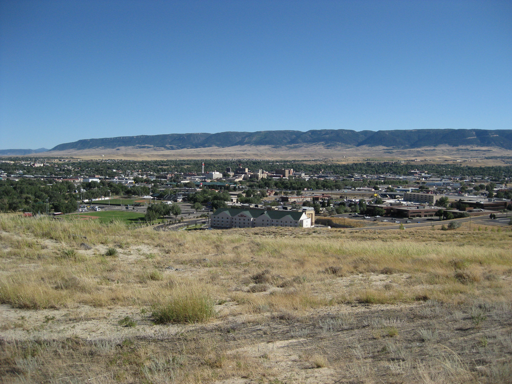
Billed by race organizers as a race with all the amenities of a larger race but without the crowds, the Casper Marathon, Half Marathon & Relay usually draws a few hundred runners each year for its three road race events, which take runners on a course along the banks of the North Platte River.

Run in what is normally some of the best weather of the year here in Wyoming’s second-largest city (Casper had a population of just over 55,000 in 2010), the race offers a hilly, scenic course and the chance to jump in the river and cool down at the finish line.

This is not a marathon that draws casual runners and walkers. Instead, it is made up mostly of veteran marathoners, Marathon Maniacs, 50-Staters, and the Marathon Geezer Patrol.

Course highlights

The course starts at the Casper Events Center. The Events Center is on the bluff above the Platte River and the City of Casper. A large indoor space is available for warm up, pre race water, PowerAde and food, and restrooms. The City of Casper, Wyoming, a Marathon sponsor, operates the Events Center. Ample parking is available at the Events Center, or for intrepid souls wanting a warm up walk, the Ramada Plaza Riverside finish line is 120 feet and ½ mile below.A shuttle bus will run between the Event Center and the Host hotel before the marathon, half marathon and relay. The starting line is located on the entrance road near the statue of city namesake Caspar Collins, the U.S. Calvary officer killed in an Indian battle in May, 1865. The route proceeds along Events Drive, then turns north onto East Road. The course passes the Model Airplane facility and the Casper Speedway, two of many City of Casper recreational facilities in the area. Watch for antelope herds in the area. Turn left (west) on East Road past the East Road/Amoco Road aid station at mile 1.25 onto Amoco Road, and up a slight uphill stretch. To the north is Soda Lake, originally an oil refinery waste water site, now a bird sanctuary. The next left puts you on North Poplar to the Poplar/Events Drive aid station at mile 3.1. The course turns back on Events Drive and the East Road/Amoco Road aid station at mile 4.4. Turn right (east) on Amoco Road to a rolling stretch to Bryan Stock Trail road at mile 5. The view to the south is of Casper Mountain, elevation 8200 feet. The Mountain is a recreation gem for the City, with downhill and cross country skiing facilities in the winter, and mountain bike and running trails, picnic and camping in the summer. This section of the course drops 120 feet to the Platte River, and the Platte River Trails/ Soccer field aid station at mile 6. The remainder of the Marathon follows the Platte River Trails, a paved recreational trail operated by the Platte River Trails Trust, and the recreational trails on the Platte River Commons. This recreational corridor extends 11 miles following the Platte River through Casper. The softball field bridge at mile 6.5 is the second of nine river crossings. The next mile and one half runs through Crossroads Park, an undeveloped park area. Oregon Trail wagon ruts are still visible in the park. Watch for deer and antelope in the area. At mile 8 the Crossroads Aid station is adjacent to the Crossroads Adventure Park, a Casper Rotary Club Centennial Project. The trail runs passes behind the outfield fence of Lansing Field. Runners pass the finish area at the Ramada Plaza Riverside and cross the Platte at mile 10.7. After crossing the Platte River and looping beneath the interstate, the Parkway Plaza comes into view. The course parallels the Platte River and passes several boat launching areas and the Old Town miniature golf course at Mile 8.5/25.8. An aid station is located behind the K2 Radio building at miles 9/25.5. A loop under First Street leads to another crossing of the Platte River and past the Jonah Bank. Look for sculptures along the bank and the fisherman statute midriver. The oil derrick at mile 9.5/ 25.3 celebrates the Natrona County oil and gas industry. Oil and gas production spurred the growth of Casper and Natrona County when the famous Salt Creek Oil Field opened in the 1880’s. The infamous Teapot Dome Oil Reserve Field, thirty miles north of Casper, was central to a national scandal during President Harding’s administration in 1922. Across the river is the former site of the Amoco oil refinery, which operated from 1910 to 1990. It has been redeveloped into a Platte River Commons Business Park. The course passes through Amoco Park and the Casper Whitewater Park. There are 5 white water drops for kayaks, canoes, and other watercraft. Marathon runners continue west to the Pump House building. This building originally housed equipment used to pump refinery waste waters to Soda Lake north of the Casper Events Center. The building was remodeled in 2009 and is the home of the Platte River Trails Trust. This area is a year round center for running and biking events in Casper. Runners turn left (south) across the bridge then east on the Platte River Commons Business Park trail system. This beautiful section of the course loops around the Platte River Commons Business Park and Three Crowns Golf Course, a Robert Trent Jones designed course. Two aid stations will be located on this loop- at King Boulevard near Poplar Street,(miles 11 and 13) and at King Blvd and 13th street (mile 12). Runners will pass the old Amoco Building, built in the 1920’s, recently remodeled as a business incubation center. The trail continues past the Basco Building, which houses the Wyoming Oil and Gas Conservation Commission. Look for sculptures made from oil field equipment and tubing, and an antique wooden drilling rig in the parking lot. Continue past Three Crowns Golf Clubhouse and an office building before returning to the trail (west) on the banks of Platte River. At the Pump House Bridge, marathon runners will turn left (west), and continue towad the Town of Mills 1st Street Park aid station at mile 12. This stretch of trail passes behind the Westech plant, a manufacturer of equipment used in coal mining operations. You will cross the bridge on the east side of Wyoming Boulevard over the Platte River and on to the NEW pedestrian underpass, which provides traffic free crossing under Wyoming Boulevard. On the right, as you cross the bridge, is Fort Caspar Park, a city-operated museum containing a wealth of information about the history of Casper, including the military and immigrant trails. The next aid station is at Morad Park, mile 15/21. The trail continues through Audubon Park, past the Wyoming Game and Fish headquarters and Casper BLM office. The trail leaves the river and goes up a short, but steep, little hill to Magnolia Street. A gradual downhill leads to the turnaround point close to Paradise Valley Park aid station at Mile 19. The return trip follows the river downstream, past the Morad Park aid station, Mills First Street Park aid station, the Pumphouse aid station and the K2 Aid station. Now just less then a mile to the Ramada Plaza Riverside and across the finish line. Relax, Smile, you did it! CONGRATULATIONS!!
Leggi di più

Recensioni

Terribile star_border
Povero star_border
Ok star_border
Molto bene star_border
Eccellente star_border

Puoi essere il primo a scrivere una recensione per questo evento

Casper Marathon

schedule Annullamento del biglietto 24h

local_activity Offerte e sconti

verified_user Refundable Booking

Le informazioni sulla gara provengono dal sito ufficiale dell'evento o da fonti pubblicamente reperibili. Consulta sempre il sito web ufficiale per le ultime informazioni sulla gara. Informaci tramite email. se alcuni dati sono errati o mancanti.