Annapurna 100

Pokhara, Nepal

29 ott 2022 (Sat)

directions_run

55km, 42,40km, 100km

Annapurna 100

schedule Annullamento del biglietto 24h

local_activity Offerte e sconti

verified_user Refundable Booking

Join Annapurna 100

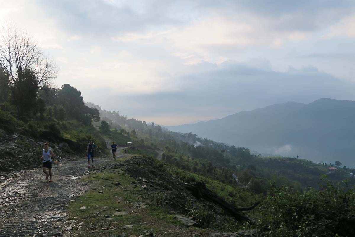
For mountain lovers and the vertically inclined the Himalayas represent nothing less than the crowning apex of nature’s grandeur. Here dramatic forested gorges rise to skylines of snow-capped glaciated peaks through a landscape that ranges from high-altitude desert to dripping rhododendron forest. Home to some 40 million people, this is no alpine wilderness, but rather a vibrant mosaic of peoples, cultures and communities, criss-crossed by ancient trading and pilgrimage routes that offer their own unique inspiration. Test your mettle against some of the world’s most audacious and dangerous roads, or set a more measured pace on a trek through yak pastures to prayer flag-strewn passes haunted by snow leopards and red pandas.

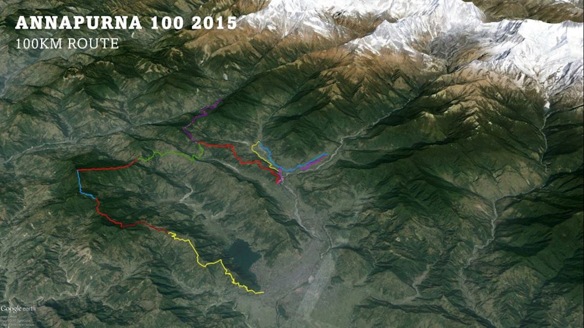
Annapurna is a massif in the Himalayas in north-central Nepal that includes one peak over 8,000 metres, thirteen peaks over 7,000 metres, and sixteen more over 6,000 metres. This is home to the Annapurna 100.

Course highlights

50K

A super nice route that mixes paddy, peaks and pings – from Begnas lake to the hillside village of Sikles.

An almost flat run for the first 8km before some climbs around the lake of Rupa Tal. Through the rice fields at Rupakot then a climb to Bhanjyang to join the old stone paved trail to the hill top. Some flat running on a jeep track to Tiwaridanda and a drop down to a river. An 8km slow climb to Yangjakot, the pleasant hilltop village with views to the Himalayas. Follow the 100km description below for more details. Sting in the tail like a scorpion, with a 700m climb on stone steps to finish. If you can’t finish, someone will have to carry you. So please sleep in Tangting or just finish!

100K

Actually about 98.5km currently according to this track.

100km runners will like and not like the first section. Quite a lot of pitched road, but easy to navigate and warm up to. As dawn breaks views to the mountains north. By 25 km you reach a pleasant lake Rupa. Some small climbs and rice paddies. At 33km the first slow climb on an ancient stone trail. A short sharp descent, then another climb to Gurung village of Yangjakot with views to the Himalayas at 50km. Back down to river level, then climb again to Tangting, a super authentic Gurung village again, again with mountain views (cloud permitting). Yet again down the the river and a 700m climb to Sikles, a village of 3000 people on the hillside. Then jungle / forest – a challenge for slower runners who take this on in the dark. Slippy wet trails through lush cloud forest. A climb of 900m over 12km on a good trail. Then inevitable descent, to the final checkpoint at Ghalekarka, and back to jeep tracks for the final, easier 13km to the finish. Accommodation provided for all at the finish – shower, food, bed and transport to Pokhara on Sunday morning.

Leggi di più

Mappa del percorso

directions_runStart address: Pokhara,np

flagFinish address: Pokhara,np

Annapurna 100 Mappa del percorso

Recensioni

Terribile star_border
Povero star_border
Ok star_border
Molto bene star_border
Eccellente star_border

Puoi essere il primo a scrivere una recensione per questo evento

Annapurna 100

schedule Annullamento del biglietto 24h

local_activity Offerte e sconti

verified_user Refundable Booking

Le informazioni sulla gara provengono dal sito ufficiale dell'evento o da fonti pubblicamente reperibili. Consulta sempre il sito web ufficiale per le ultime informazioni sulla gara. Informaci tramite email. se alcuni dati sono errati o mancanti.