Gomeda Ultra Trail
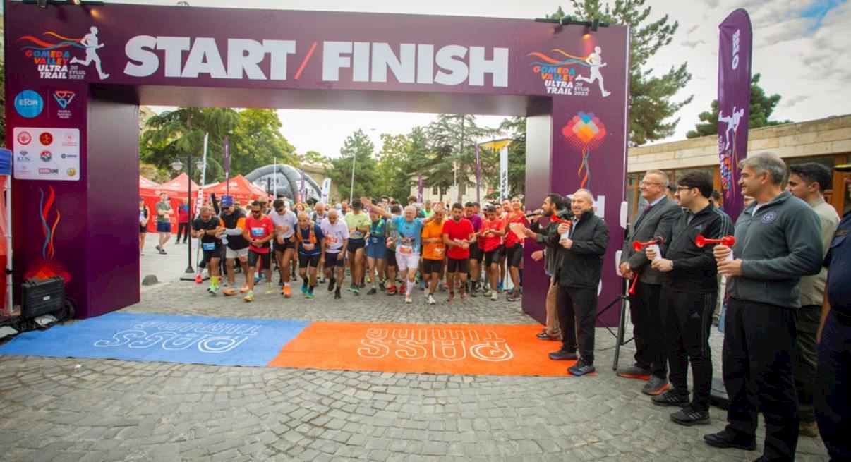
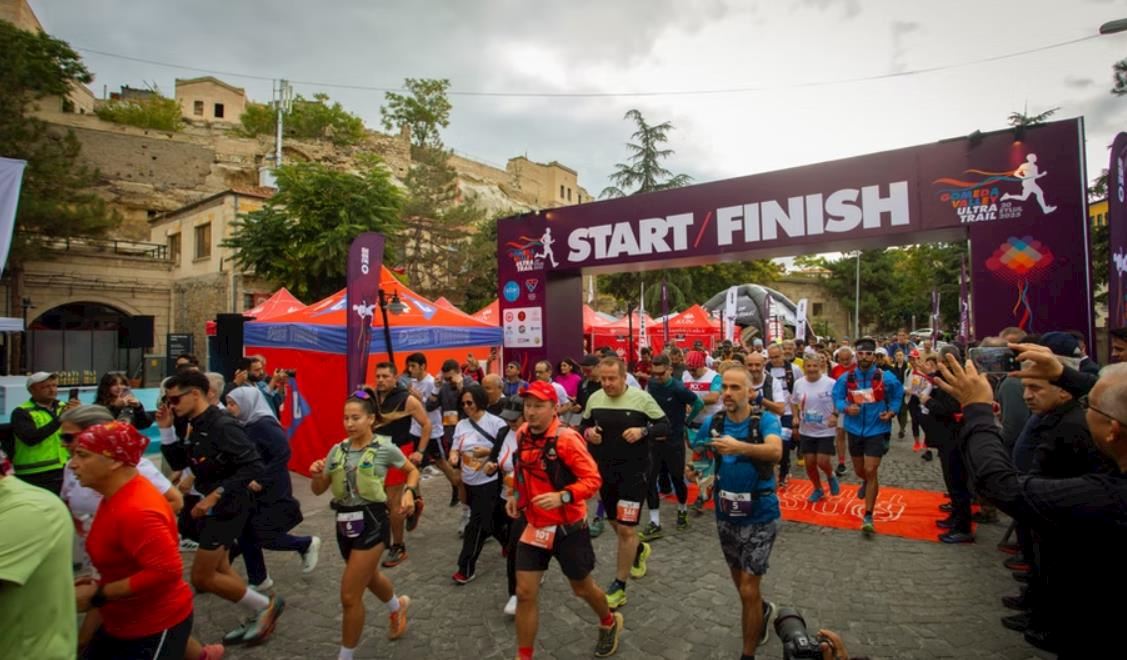
Join Gomeda Ultra Trail
Are you ready for an adventure in the heart of nature?
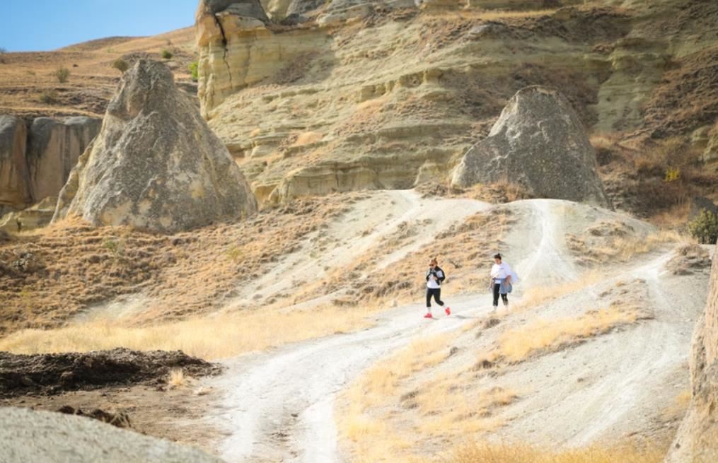
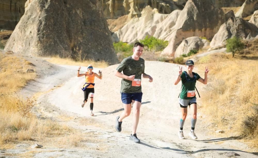
Hidden within the enchanting landscapes of Cappadocia, the Gomeda Ultra Trail offers a truly unique experience for trail runners. Picture yourself exploring scenic routes that wind through fairy chimneys, breathtaking valleys, and ancient pathways, all beginning and ending in the historic town of Mustafapaşa. The race promises not only professional organization with health, safety, and support stations, but also an immersive journey through both history and the natural world.
This is more than just a race it’s a discovery and a chance to connect with nature, history, and your own endurance. Every step brings you closer to the landscape and to yourself. Secure your place now for this unforgettable adventure.
Course details
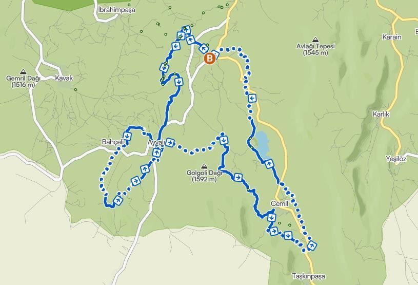
As the longest, most prestigious, and most challenging course of the Gomeda Ultra Trail, the 50K route is specially designed for experienced trail runners who wish to immerse themselves in the natural, historical, and cultural depth of the region step by step. Recognized as the main course of the race, this stage is not just a physical challenge but a profound connection with the multi-layered spirit of Cappadocia. Starting Point: Mustafapaşa The race starts in Mustafapaşa, a village in Nevşehir known for its historical and architectural character. Formerly called Sinasos, this charming town with its Greek architecture, stone houses, and narrow streets welcomes runners with a cultural atmosphere and immediately transports them into a time tunnel. Valleys and Regions Along the Route Throughout the 50K course, participants traverse Cappadocia’s unique natural formations and hidden valleys rarely visited by tourists: Gomeda Valley: The first section follows Gomeda Valley, known for its fairy chimneys, rock-carved structures, and soft soil trails. Its silence and pristine nature offer a gentle start. Üzengi Valley: The trail continues along the narrow and cool Üzengi Valley, with natural springs, stone bridges, and vineyards. Runners face stream crossings and rocky paths that require technical focus. Kepez Valley & Yukarı Mahalle: As the route gains elevation, scenic viewpoints and panoramic landscapes unfold. This area offers both visual delight and physical challenge. Taşkınpaşa Village: Approaching the midpoint, runners arrive in Taşkınpaşa, a village notable for its Ottoman-era mosque, madrasa, and stone-paved streets. This is also the location of the second major aid station. Sofular – Başköy – Karlık Connection: Runners proceed toward Karlık village via Sofular, with occasional transitions to dirt village roads. Long climbs and descents test endurance. Pancarlık Valley: Nearing the final section, runners enter the rocky and narrow Pancarlık Valley. This technical segment demands focus in the late stages of the race, but the natural silence offers internal motivation.
Back to Mustafapaşa: The final descent brings runners back to the start point in Mustafapaşa. This finish signifies not just the end of a race but the completion of a personal journey.
TECHNICAL INFORMATION
The 50K course, the main route of the Gomeda Ultra Trail, starts and finishes in Mustafapaşa. It passes through some of the region’s most stunning valleys and rural paths. With its technical nature, changing terrain, and elevation profile, it challenges not only physical stamina but also strategic racing ability.
General Information
Total distance: 50 kilometers
Total elevation gain: +1,820 meters
Total elevation loss: -1,820 meters
Highest point: 1,348 m (Kepez Pass – around km 27)
Lowest point: 1,024 m (Üzengi Valley base – around km 7)
Start / Finish: Mustafapaşa Town Square
Difficulty level: Advanced
Cut-off time: 9 hours
Surface Types
The 50K course features a diverse surface structure. Below is the surface distribution:
Soft dirt trails – 55%: Through Gomeda, Pancarlık, Kepez, and Üzengi Valleys
Gravel village roads – 20%
Rocky / technical paths – 15%: Üzengi stream sections, rocky valley paths, and descents
Short asphalt connections – 10%: At Mustafapaşa exit and village crossings
The majority of the trail consists of soft, clay-rich soil, but technical rocky sections require careful steps. In wet weather, some parts may become muddy.
Elevation Profile – Key Points
0 km – Mustafapaşa (Start): 1,135 m
7 km – Üzengi Valley: 1,024 m
15 km – Yukarı Mahalle Pass: 1,210 m
22 km – Taşkınpaşa: 1,165 m
27 km – Kepez Pass (Highest Point): 1,348 m
35 km – Karlık Village: 1,245 m
42 km – Pancarlık Valley: 1,070 m
50 km – Mustafapaşa (Finish): 1,135 m
Aid and Control Stations
There are 4 main aid stations along the route. All provide water, electrolytes, energy supplements, and emergency medical support:
Station 1 – Üzengi (km 10): Water, snacks, salt tablets
Station 2 – Taşkınpaşa (km 22): Water, energy gel, fruits, first aid
Station 3 – Karlık (km 35): Salty snacks, medical crew
Station 4 – Pancarlık Entrance (km 42): Water, cola, fruits, emergency response
All aid stations also serve as chip timing checkpoints.
Note: Locations and services are subject to change.
Mandatory Equipment List
Minimum 1.5L water carrying capacity (soft flask or bladder)
Windbreaker or rain jacket (depending on weather)
Whistle
Emergency thermal blanket
Fully charged mobile phone (with organizer number saved)
Energy gels/bars (minimum 2)
Headlamp (mandatory for runners expected to finish over 7 hours)
Bandage / basic first aid tape
Important Notes
Due to the natural terrain, carrying a GPS device and power bank is recommended.
The course will be marked with reflective tape, directional signs, and colored flags.
Trail guides and safety personnel will be stationed at all technical sections.
The route will be marked following eco-friendly principles with no permanent signage left behind.
Start address: Mustafapaşa, Ürgüp/Nevşehir, Türkiye
Finish address: Mustafapaşa, Ürgüp/Nevşehir, Türkiye
Carte du parcours
What’s included
-
done Finisher medal
-
done Goodie bag
-
done Event T-shirts
-
done E-certificate/e-diploma
-
done Timing chip (single use)
-
done Expo entry
-
done Pre-race meal
-
done Shuttle to Start Line
-
done Drink Stations
-
done Nutrition Stations
-
done Medical Assistance
-
done Toilets
-
done Dressing rooms
-
done Accident insurance
Avis
Soyez le premier à rédiger un commentaire sur cet événement
Foire Aux Questions
When and where can I collect my BIB/race pack?
Race packs can be collected in Mustafapaşa Town Square on the day before the race between 10:00 and 18:00, or on race day from 06:30 to 07:30.
How do I get to the race location?
It is possible to reach Gomeda Valley by private vehicle or by the service hours determined by the organization. Transportation details will be announced in advance.
What is the cancellation/refund policy for this event?
Up to 45 days in advance: 80% refund. Up to 30 days in advance: 50% refund. 30 days and later: no refund, name transfer is accepted. If the race is cancelled due to adverse weather conditions or force majeure, a 75% refund will be made.
Les informations de course ont été trouvées sur le site officiel de l'événement ou par des sources accessibles au public. Toujours se référer au site officiel pour les dernières informations sur la course. Veuillez nous informer si des données sont fausses ou manquantes, en nous envoyant un e-mail..


