Volcanic 50

05 ago. 2023 (Sat)

directions_run

50km, 25km

Volcanic 50

schedule Canceación de ticket 24H

local_activity Ofertas y descuentos

verified_user Refundable Booking

Join Volcanic 50

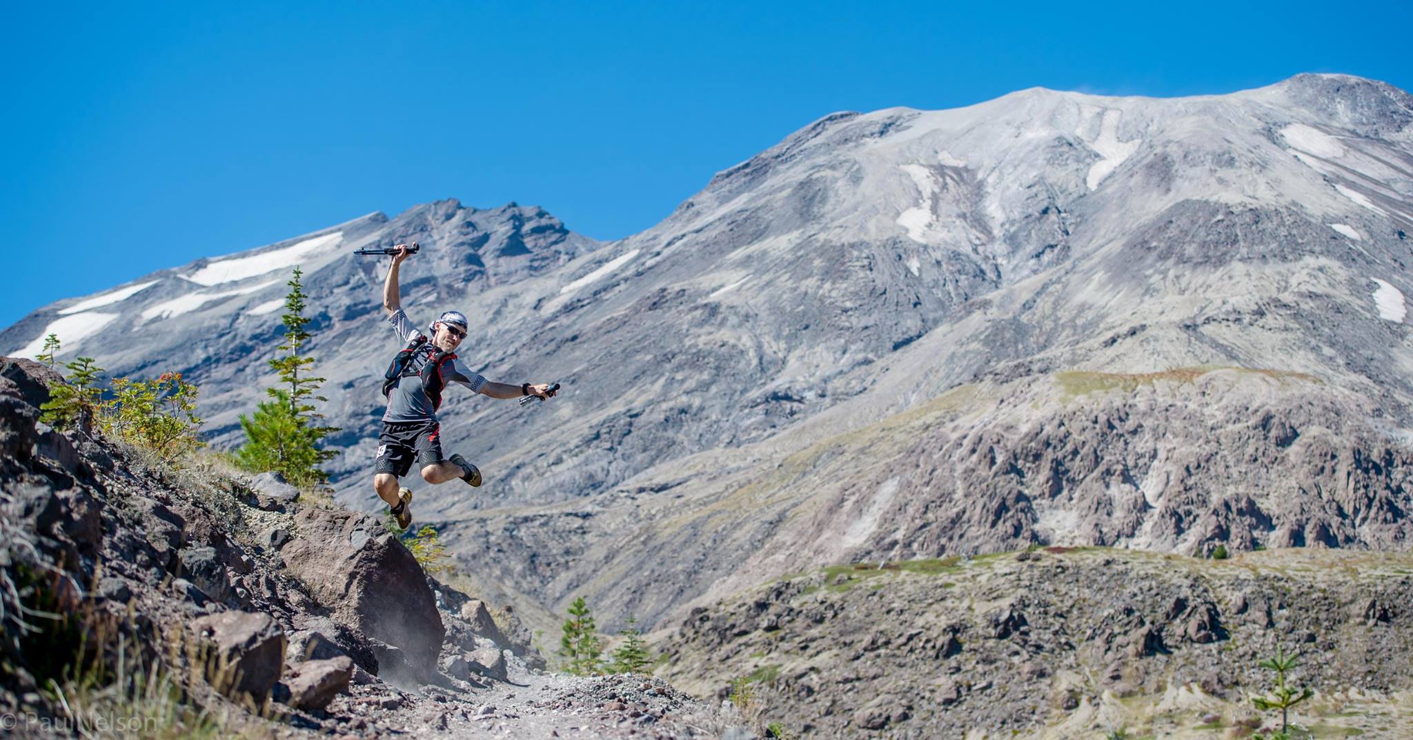
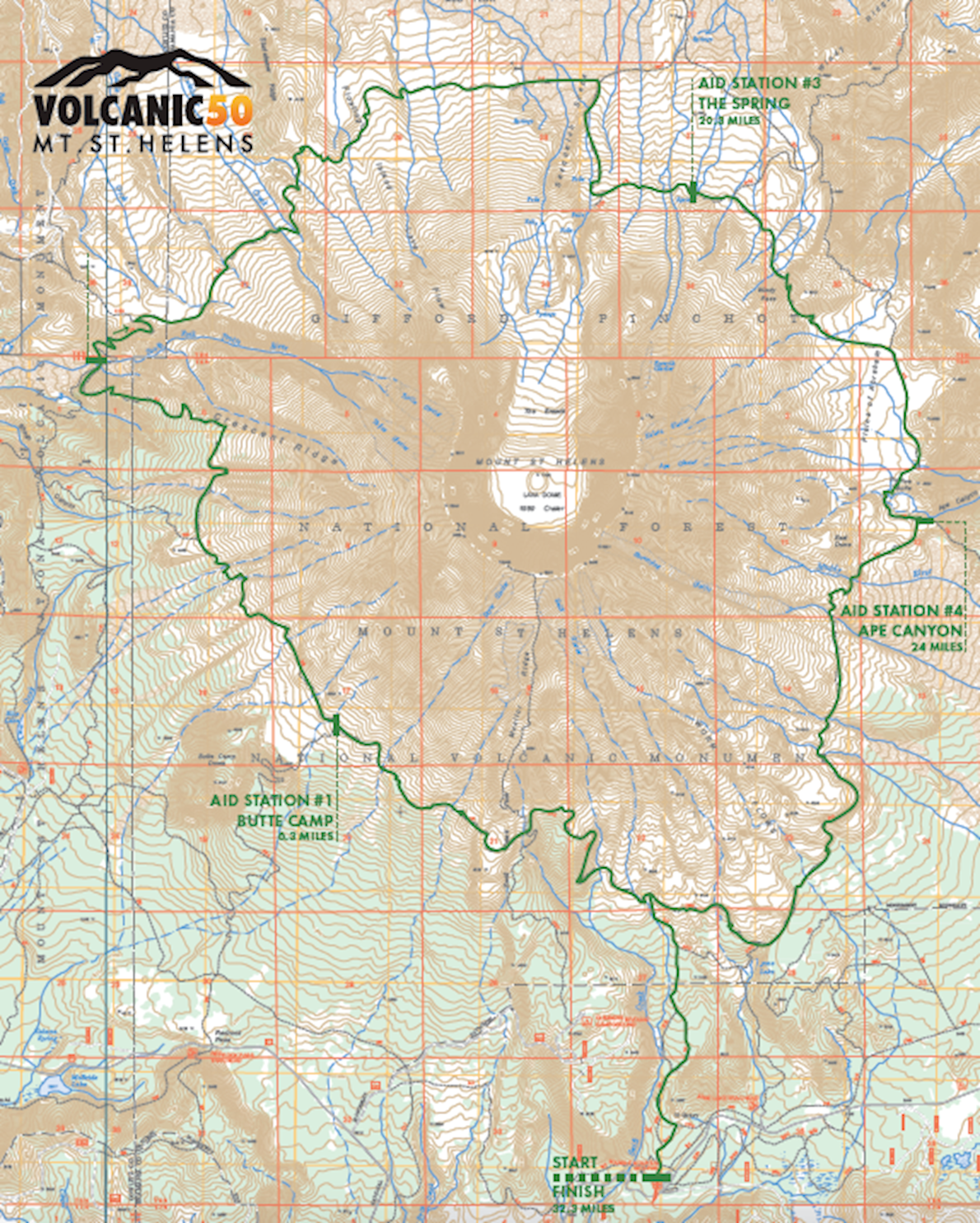
A remote and challenging course with over 7400 ft of elevation gain and loss circumnavigating Mt St Helens, all on rugged, single-track trails covering 32.3 miles. All but 4.5 miles are on the Loowit Trail. You will travel over lava and pumice fields, crossing rivers, through the blast zone as well as through dense forests.

You will travel clockwise around the mountain.

Course highlights

Start to Butte Camp/Aid Station 1 (Mile 6.3)

In this section, you will cross a few lava fields. Be on the lookout for course markers [there are also trail markers with logs sticking above a mound of rocks (cairns)] as you will probably be focusing on your footing. Footing will be loose or you will be hopping from one rock to another.

Within a mile after gaining the Loowit Trail, there is a relatively steep climb the lasts for about a mile. At the top of this climb, you will cross-over the main trail leading to the summit of Mt St Helens. Longer stretches of “level” ground awaits for the trip to Butte Camp Aid Station (AS 1) at mile 6.3.

Aid Station 2 to Toutle River/Aid Station 2 (Miles 6.3-12.2)

A few miles after aid station 1, you will drop ~1600ft to the Toutle River through dense forest (the most shaded section of the course), reaching the Toutle River Aid Station (AS 2). This is a fully stocked aid station, with filtered water, but you can fill up your bottle(s)/bladders from the river if you choose.

Aid Station 2 to The Spring/Aid Station 3 (Miles 12.2-20.3)

Once you pass the Toutle River Aid Station, there is virtually no shade till you get to within 3.5 miles of the finish. You WILL be exposed to the elements. It can be any one or a mixture of the following conditions: hot, windy, cold, rainy, snowy.

Trail conditions on this section are varied from sandy (just beyond the Toutle River Aid Station) to rocky/sandy (in the blast zone) to great hard compact (in between the sections just mentioned).

You immediately climb ~800ft from the Toutle River. From the top of this climb, you drop in and out of a number of canyons. After these canyons you cross the expanse of the blast zone. Here you will cross a number of small creeks/rivers.

is a water source (the spring) at around mile 20.3 and this is where aid station 3 is located. This is another fully-stocked aid station with water (from the spring)….and friendly faces. Please fill up your water bottle/bladder at this aid station.

Aid Station 3 to Ape Canyon/Aid Station 4 (Miles 20.3-24.0)

About 1.25 miles beyond aid station 3 you will reach the highest point on the course – Windy Pass – at an elevation of 4950ft. About a ½ mile after dropping down off Windy Pass where the trail is sandy & rocky, trail conditions improve. It is pretty much level running all the way to Ape Canyon Aid Station 4.

Make sure to fill up your water bottle(s)/bladder before heading out as there is still a ways to go to the finish (8 miles).

Aid Station 4 to Finish (Miles 24.0-32.3)

You will drop in and out of canyons…..that seem to go on forever. However, they will eventually end. Just be aware that there is very little shade. Do not be tempted to turn onto the June Lake trail at the junction, it’s not much of a lake and is not the finish line.

You will cross multiple boulder fields before you get to head down Trail 244 to the finish!

Leer más

Mapa de ruta

directions_runStart address: Marble Mountain Sno-Park,us

flagFinish address: Marble Mountain Sno-Park,us

Volcanic 50 MAPA DEL RECORRIDO DE

Comentarios

Terrible star_border
Pobre star_border
Ok star_border
Muy bien star_border
Excelente star_border

Se el primero en escribir una reseña para este evento

Volcanic 50

schedule Canceación de ticket 24H

local_activity Ofertas y descuentos

verified_user Refundable Booking

La información de la carrera se ha encontrado en el sitio web oficial del evento o en otras fuentes de acceso público. Consulta siempre el sitio web oficial para obtener la información más actualizada sobre la carrera. Si falta algún dato o hay algún error, envíanos un correo electrónico para informarnos..