Flagstaff to Grand Canyon Stagecoach Line 100 mile Ultra & Relay

Join Flagstaff to Grand Canyon Stagecoach Line 100 mile Ultra & Relay
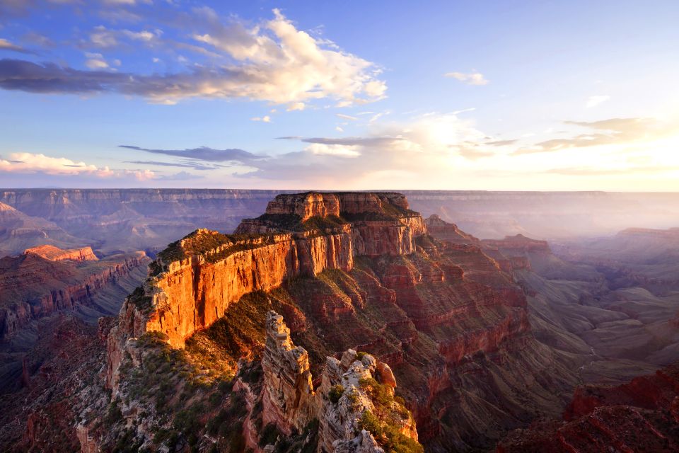
The Arizona National Scenic Trail stretches 800 miles across the entire length of the state to connect deserts, mountains, forests, canyons, wilderness, history, communities and people. This non-motorized trail showcases Arizona’s diverse vegetation, wildlife and scenery, as well as unique historic and cultural sites. Starting at the U.S.-Mexico border, the path climbs and descends from one "sky island" mountain range to another, gaining and losing thousands of feet in elevation and traversing biomes ranging from desert to boreal forest. Continuing across the Sonoran Desert, the route crosses the Gila River, winds through the Superstition Mountains and the Mazatzal Wilderness on its way to the Mogollon Rim and majestic San Francisco Peaks. The trail north takes travelers across the Grand Canyon through billions of years of geology. Topping out on the North Rim, conifer forests dominate the Kaibab Plateau, eventually giving way to red bluffs dotted with sagebrush as the trail nears the Utah border on the edge of the Vermilion Cliffs National Monument. It is the backbone of Arizona.
The race begins north of Flagstaff, Arizona, at the Flagstaff Hotshots Ranch off Snowbowl Road and finishes in Tusayan, Arizona, near the entrance of the Grand Canyon National Park. A majority of the Stagecoach course follows the Arizona Trail and the historic Flagstaff to Grand Canyon Stage Line route used by adventure seeking tourists between 1897 and 1901. Many of today’s race-day aid stations are located at the original stage line rest stops and watering holes. Course footing varies from single-track to varying degrees of two-track and forest dirt roads. Runners pass from heavily vegetated ponderosa pine and alpine aspen forests to sparsely vegetated pinion-juniper grasslands and back again. The course starts at 7,400’ (Hotshots Ranch), reaches a maximum elevation of 8,800’ (at Aspen Corner, mile 6), finishes at 6,600’ (Tusayan), and has approximately 7,000’ of climbing. Runners traverse over a shoulder of Arizona’s highest mountain, Humphrey’s Peak, through the high alpine meadows of the Hart Prairie Preserve, across 422-square mile Babbitt Ranch, and along the Coconino Rim where views of the Grand Canyon, Painted Desert and Navajo Mountain await.
Comentarios
Se el primero en escribir una reseña para este evento
La información de la carrera se ha encontrado en el sitio web oficial del evento o en otras fuentes de acceso público. Consulta siempre el sitio web oficial para obtener la información más actualizada sobre la carrera. Si falta algún dato o hay algún error, envíanos un correo electrónico para informarnos..


