Bryce Canyon Ultra Marathons
Join Bryce Canyon Ultra Marathons
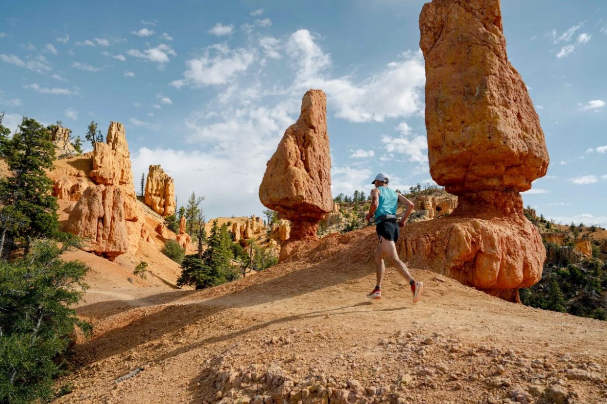
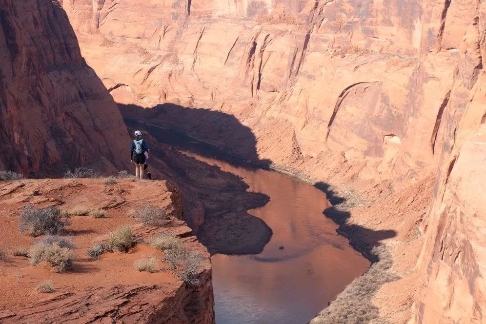
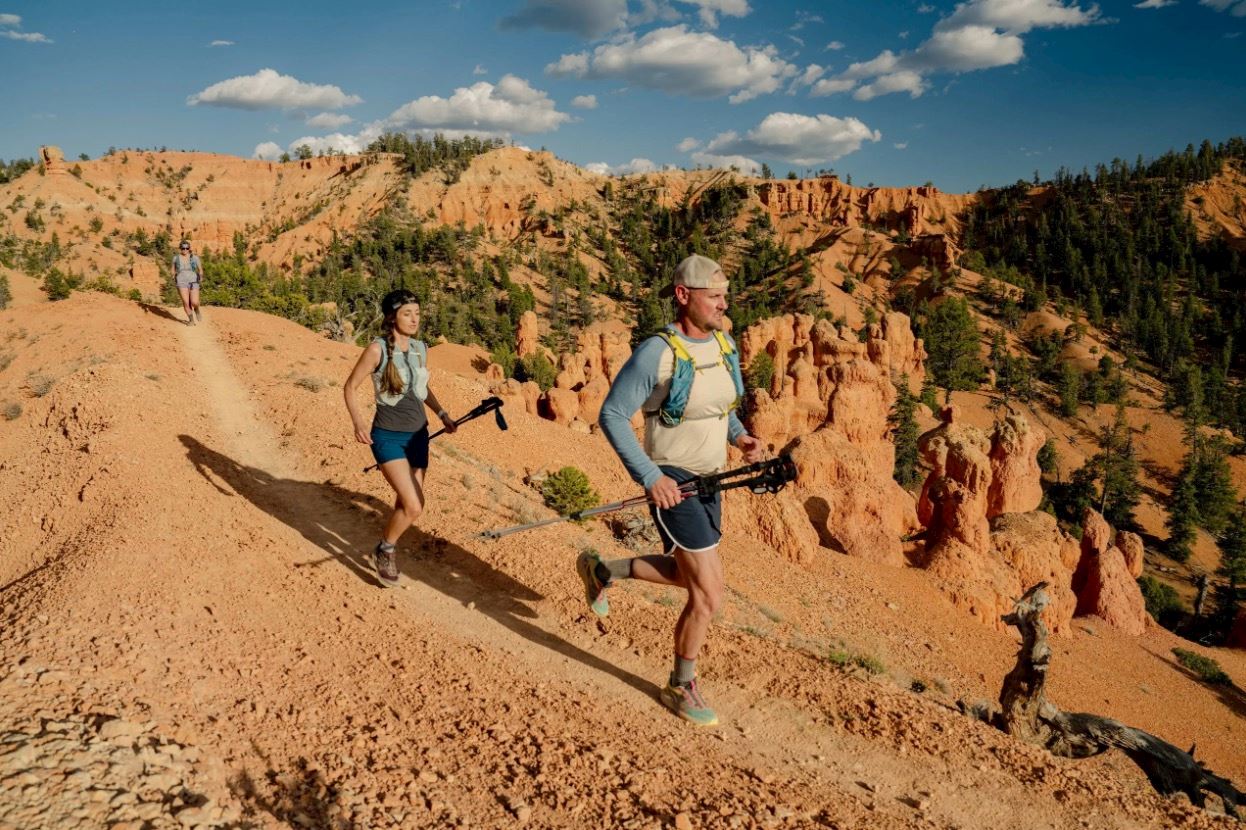
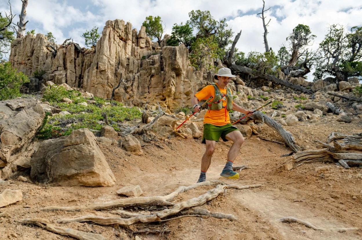
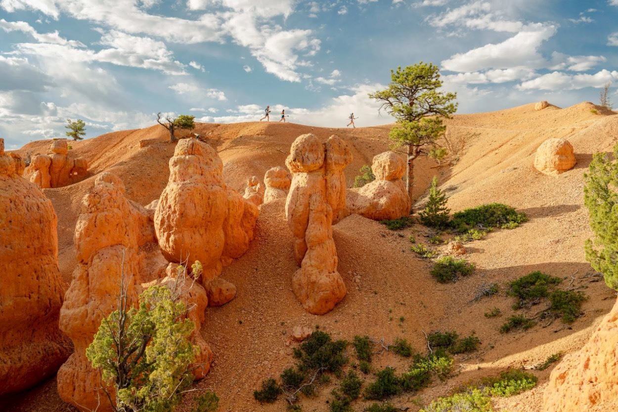
Experience the Bryce Canyon Ultras, a high-elevation trail race that takes athletes through the breathtaking landscape of Utah's iconic hoodoos. Choose from challenging distances of 50 miles (80.5 km), 60K, 50K, and 30K as you tackle the rugged terrain ranging from 7,000 to 9,000 feet (2,130–2,740 meters). The course winds along the Paunsaugunt Plateau offering panoramic views above Bryce Canyon’s stunning spires and through dense pine forests. Prepare for steep climbs, forest roads, and exhilarating singletrack descents. The remote setting and early morning start create an intense, immersive atmosphere, driven by a passionate trail-running community. As part of the Ultra Adventures series, this event combines bucket-list landscapes with demanding courses. An intimate pre-race expo and a scenic post-race atmosphere complete the unforgettable experience.
Detalles de la ruta
Start address: Lucky 7 Ranch, U.S. 89, Hatch, Utah, USA
Finish address: Lucky 7 Ranch, U.S. 89, Hatch, Utah, USA
What’s included
-
done Finisher medal
-
done Event T-shirts info
-
done Timing chip (single use)
-
done Drink Stations info
-
done Nutrition Stations
-
done Medical Assistance
-
done Toilets
Comentarios
Se el primero en escribir una reseña para este evento
Preguntas frecuentes
When and where can I collect my BIB/race pack?
Friday, September 18, 2026 Recommended! Expo Bib Pickup Hours: 2:00 - 7:00 p.m. MT 2:00 - 7:00 pm MT: All distances may pick up their race bib at the expo, which is located at the staging area in Lucky 7 Ranch. Pickup on Saturday: 4:00am near the start line until 30 minutes before your race start time.
What is the cancellation/refund policy for this event?
Please note that we don’t offer refunds on race registrations. You can transfer your bib to someone else up until the Wednesday before race day, or you can defer your registration to next year’s event or any Vacation Races Ultras event in the Ultra Signup platform. Please ensure your request is made at least two weeks prior to race day. Deferrals come with a fee equal to 50% of the registration cost, which will be deducted from your credit when signing up for that event.
Cup-free event
In order to minimize trash created, this will be a cup-free event. You'll be required to have your own cup for water, Gnarly, and/or soda at the aid stations (e.g. a Nathan reusable cup, a handheld water bottle, a bladder system, etc.). Cups will not be provided at the start or finish line or any of the aid stations.
Nature of these courses
We want to be very clear that these races do NOT take place inside National Park boundaries. We don't want you to be disappointed or have the wrong expectations. The courses are beautiful and scenic, and we strongly encourage you to spend time inside the park before and after the event, but the races themselves take place outside park boundaries. In addition, although we do our best to plan and prepare so we run the courses we've indicated on the website, due to the nature of permitting, working with rural land owners, and other conditions which are outside our control, courses are always subject to change. In the case of a necessary alteration, we'll try our best to find a similar course in terms of scenery, location, and difficulty/terrain.
La información de la carrera se ha encontrado en el sitio web oficial del evento o en otras fuentes de acceso público. Consulta siempre el sitio web oficial para obtener la información más actualizada sobre la carrera. Si falta algún dato o hay algún error, envíanos un correo electrónico para informarnos..


