Tahoe Rim Trail Endurance runs


Join Tahoe Rim Trail Endurance runs
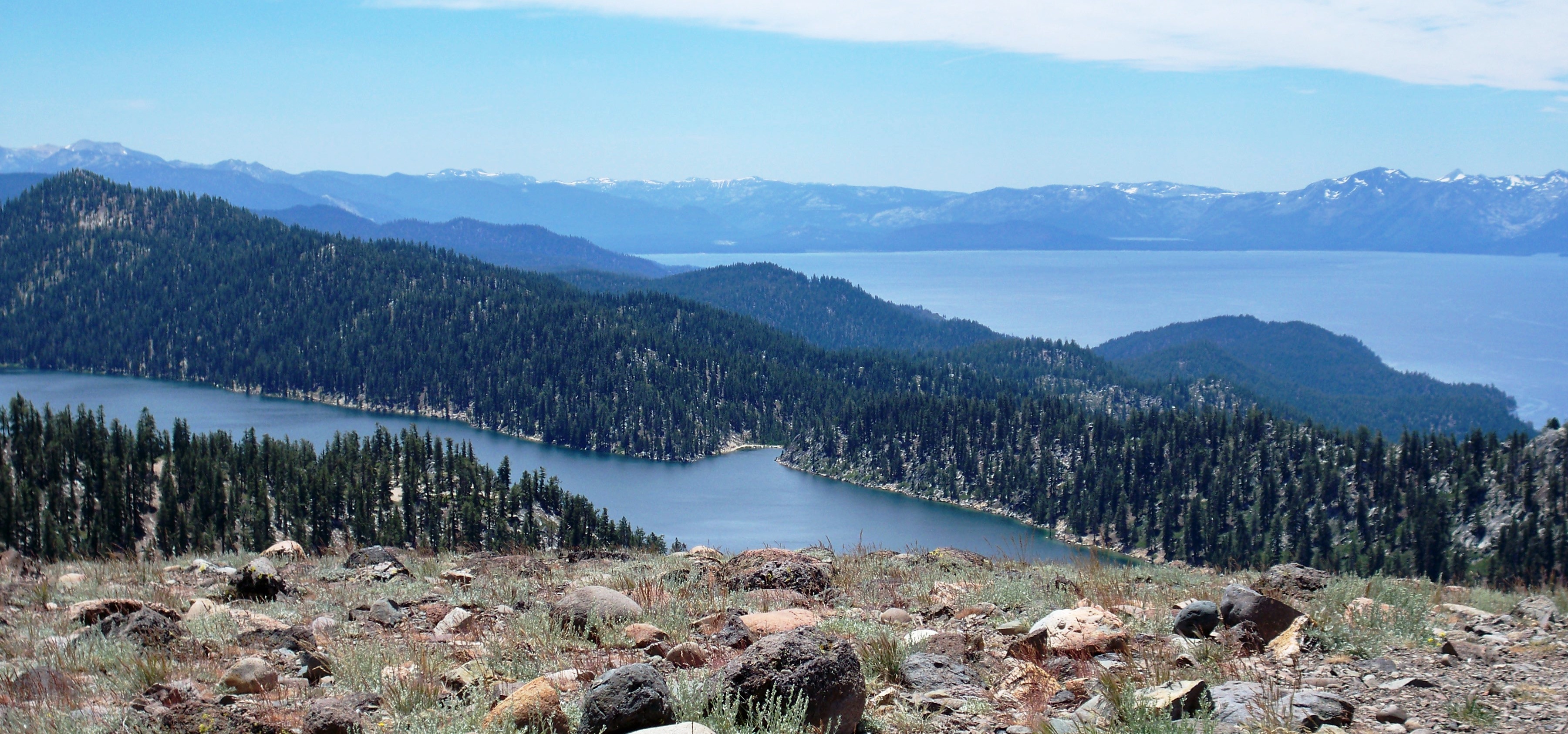
The Tahoe Rim Trail 100 mile Endurance Run takes place on high elevation alpine and sub-alpine forest trails and dirt roads in the Carson Spur of the Sierra Nevada Mountains. The event is located on the northeast side of Lake Tahoe. All distances begin and end at the Spooner Lake State Park, which is at 7,000 feet. The highest point of the event is just below the 9,214 foot Snow Valley Peak (which also provides one of the best views on the course). The low point is at the bottom of the now "infamous" Red House Loop (A Taste of Hell) at approximately 6800 feet.
The net proceeds from this event benefit the Tahoe Rim Trail Association trail maintenance program, the Lake Tahoe Nevada State Parks back country mountain bike patrol, the South Lake Tahoe and Carson City High School cross‐country teams, the Carson High School Volleyball Team, the Carson City Boy Scouts and the Carson City American Legion and more.
Course highlights
The start at Spooner Lake follows the North Canyon Road for approximately 1 mile before it veers left onto the Marlette Lake Trail. The Marlette Lake Trail meanders through conifers and Aspen groves as it climbs approximately 1,500 feet before descending about ½ mile to the shore of tranquil Marlette Lake. Upon reaching Marlette Lake (7823 feet) veer right and continue to climb on dirt roads and connecting onto the Tahoe Rim Trail. About a ½ mile further you will come to the Hobart A/S at 8120 feet and 6 miles into the race.
After leaving the Hobart A/S the Tahoe Rim Trail climbs past Marlette Peak (photo Op) and Harlan Peak before descending on an awesome single track to the Tunnel Creek A/S 11 miles into the race. Departing from Tunnel Creek A/S you go right and down the hill (1000 feet) starting the 6.3-mile loop to the Red House A/S and back. As you are descending this trail you continue to make right hand turns until coming to the Red House A/S.
Leaving the aid station you will be on a single track flume trail leading you back uphill towards Tunnel Creek A/S. There is one intersection that will be very well marked pointing you left uphill back to Tunnel CreekC A/S. Upon returning to the Tunnel Creek A/S the 50M/100M course will travel approximately 6-miles north along single track section of the Tahoe Rim Trail. This section is mostly rolling with breath-taking views of both Lake Tahoe and Washoe Valley.
At the Incline Creek trail junction the course makes a sharp left turn and drops down towards Incline Village, offering spectacular views of the North Shore of Lake Tahoe. This section of the course will provide views of Lake Tahoe not many but locals have seen. The Incline Creek trail will plunge down the mountain for approximately four miles and a loss of 2,000 feet of elevation, following the creek with many dives including twists and turns. As the trail flattens out towards the bottom you will come into the Tyrolean Village area directly behind homes. From there the course will follow the dirt service road up the ski run and onto the Crystal Ridge ski run up and over the top of Diamond Peak resort at 8540 feet for a 1700 foot climb in just under 2 miles.
When you reach the top of the ski lift (bull wheel), a sharp right hand turn will drop you down to the Bull Wheel A/S (water and typical aid station fair only. No hot food and no ice will be there) turn right onto the Tahoe Rim Trail. The course then returns to the Tunnel Creek A/S 3 miles south for the third time. From the Tunnel Creek A/S, the course will follow the Tahoe Rim Trail south (straight through the A/S) back towards the Hobart A/S. During the daytime this 5 mile section will be hot. Leaving the Hobart A/S you will come to a flat road intersection, you cross the road and veer left continuing on the Tahoe Rim Trail. You will be on TRT for three spectacular miles climbing 1000 feet to the Snow Valley Peak A/S.
Leaving the Snow Valley Peak A/S you will continue along the Tahoe Rim Trail about 5.5 miles before reaching the Spooner Summit Trailhead A/S. This part of the course winds around many turns but there is nowhere to get off the trail, just keep descending for what will seem like a very long way. You sweep around a corner at the aid station connecting with the Spooner Lake trail for the final 1.7 miles to the Stonehenge-50 Mile A/S along a beautiful aspen grove and the shores of Spooner Lake.
Route map
directions_runStart address: Lake Tahoe,us
flagFinish address: Lake Tahoe,us
评论
Be the first to write a review for this event
赛事信息可以在在赛事的官方网站或通过公开渠道找到。 总是以官方网站上的最新赛事信息作为参考。 如果有任何数据错误或遗失,请通过电子邮件告知我们.