


Join Six Foot Track Marathon
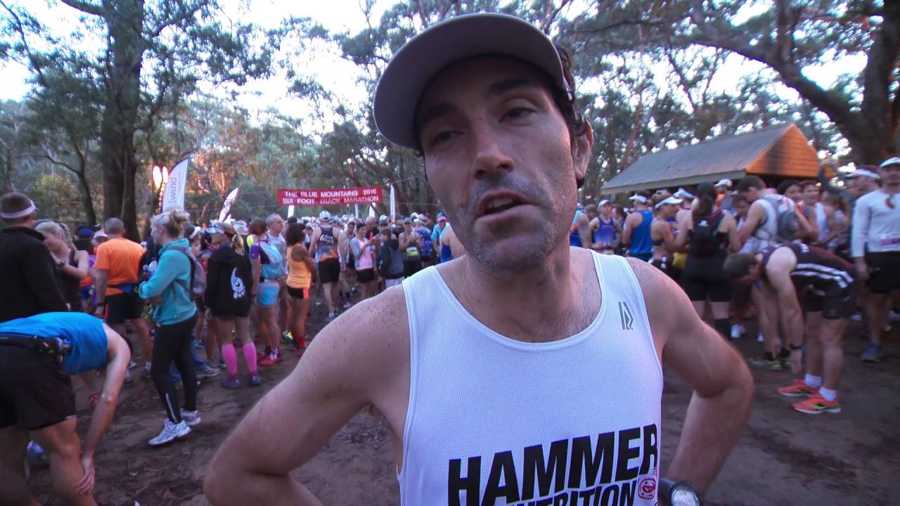
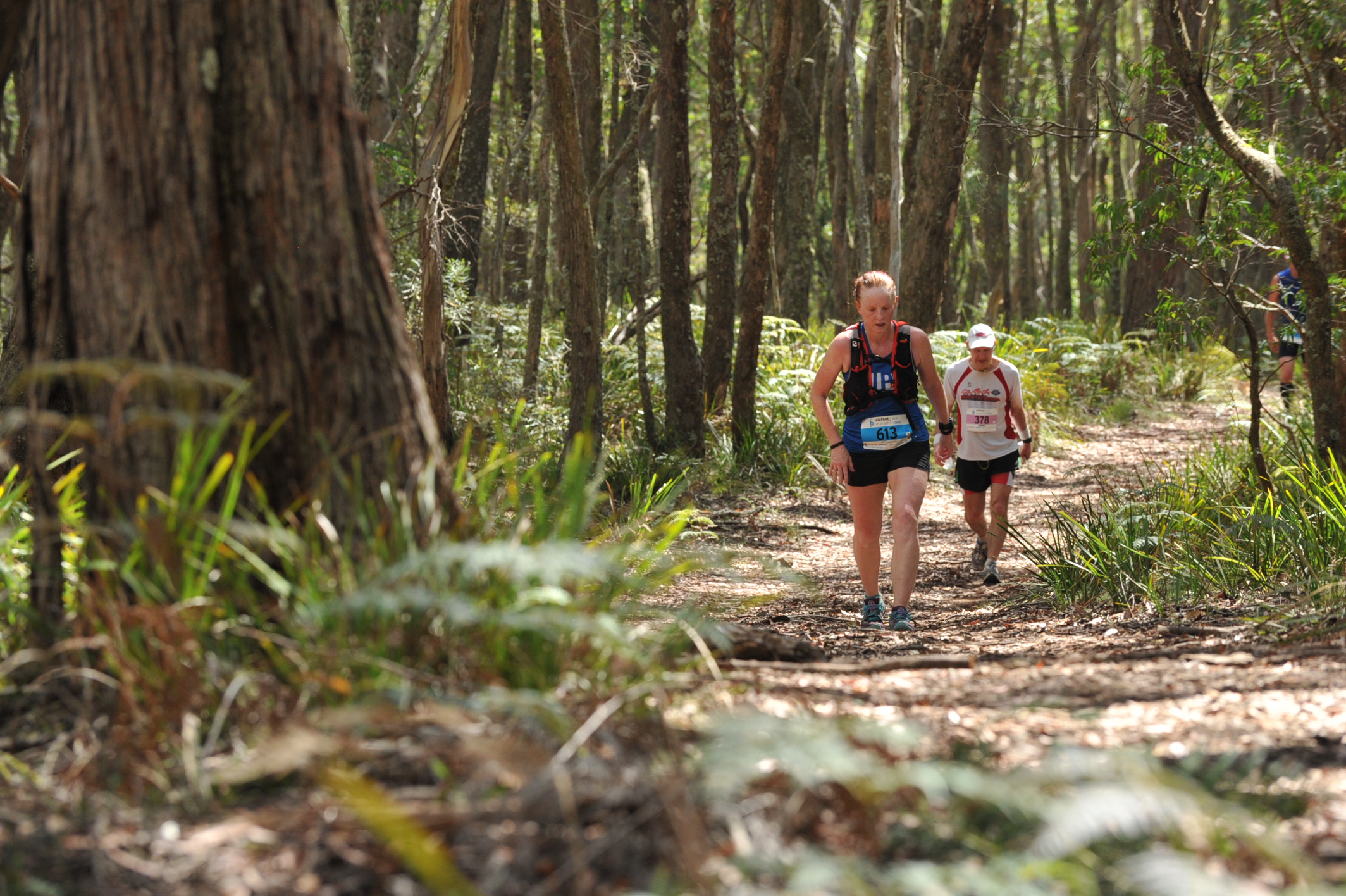
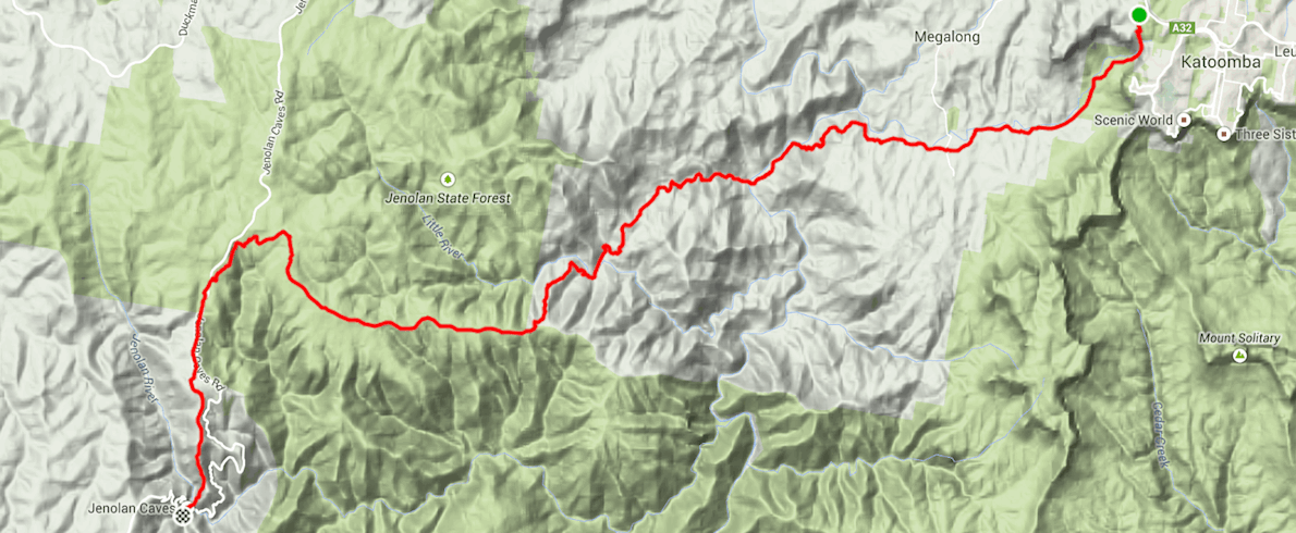
What has been described as "the toughest marathon in Australia, if not the world" is held each March in the Blue Mountains, Katoomba, NSW, Australia, sandwiched between the brutal bush fire season and Easter. With more than 25 years of experience under its belt, this is the premier trail Marathon in Australia, and it is expected that the full quota of 850 runners will start each year’s event. The runners will run along the Six Foot Track, a bridle trail originally cut in 1884 starting from the Historic "Marked Tree" at Katoomba to the Jenolan Caves, a distance of 45 kms.
The gruelling race was launched in March 1984 to mark the centenary of the opening of this historic track. Since the first race, which fielded a mere seven runners, the event has attracted much acclaim for its toughness, its stunning scenery, challenging conditions and great camaraderie. The event now attracts a field of local, national and international entrants who travel from as far as Germany, New Zealand, Japan, Ireland, England and the USA.
They come from all walks of life – business people to triathletes with many runners returning year after year. Females account for 15% of the field and this is increasing yearly. The event is arduous, do not be mistaken, but is a great challenge for all. There are steep hills to go up and down, and the mighty Cox’s River to cross. There is dirt and dust, and heat and humidity, as the event is at the tail-end of the long hot Australian summer.
Course highlights
The first few hundred metres are wide, steepish downhill fire trail. There are quite a few waterbars to step over and some sections are rutted from erosion. The field usually sprints here to get into best position for the stairs.
At a hard right hand turn, pass a wooden barrier and the trail narrows to the Nellies Glen staircase. No matter what the weather, water is always dripping down the rock face on the right, making the footing slippery. At first the stairs are demarcated by wooden boards, further down they become less regular in structure and are cut out of the rock.
Cross over the small creek coming in from the left at a rocky section, then the steps end and the trail improves considerably. At first a narrow, well graded singletrack, it broadens out into a dirt road (Nellies Glen Rd) descending into farmland. Again, there are a number of waterbars to step over early on- be careful. The bottom of the stairs is the 1.7K mark.
As you enter the farming land, it's safe to look up to the left and admire the cliffs of the Narrow Neck plateau. On the right Megalong Creek has cut a gully the trail runs parallel with. At one point the track divides in two- a vehicle track branches away to the right while the "correct" trail cuts through some vegetation straight on, but both trails meet up again a hundred metres or so further on. It's reasonably flat here- certainly all runnable, anyway.
Nellies Glen Rd is the race course until about the 6K mark when it bears hard right at a ford while the runners cross the ford (you shouldn't get your feet wet) and run across a paddock. The route has been worn into the grass by countless pairs of feet- it climbs a small rise into a stand of trees and becomes a narrowish but good quality singletrack cutting through scrubby bush. Runners climb a few stiles over fences and emerge from the bush at Megalong Valley Rd, the 8K mark.
Cross the road, step over a cattle grid, then follow a broad dirt road downhill. The old Megalong Cemetery is on your left immediately after leaving Megalong Valley Rd behind but it's hard to notice any details with all the overgrowth in there. The road enters farmland, bottoms out and commences a gradual uphill, quite runnable. Megalong Creek is still wending its way on your right hand side, downslope.
The farm road winds away to the left whilst runners take a signposted singletrack straight on. It drops to a dry creek bed then climbs steeply for a minute or two (you'll probably walk this). A couple more dry creek beds are negotiated as the trail climbs towards Pinnacle Hill.
At Pinnacle Hill (approx 10K), you'll climb another stile, plunge into the bush and commence the long technical downhill to the Coxs River. The Coxs is down a steep slope on your right. the trail is at its worst early on- lots of rocks scattered across and embedded in the trail and quite a lot of loose earth and uncertain footing. In a few places there have been attempts to mitigate the erosion and loose footing by putting in wooden steps. There are several nasty falls in this section every year, so concentration is paramount. Due to the narrowness of the trail, queues of several runners can easily form when it's impossible to pass a slower or more uncertain runner. The conditions improve a little as the trail drops closer to the river but there's still plenty of rocks and winding in and out of trees. When the swing bridge appears over the river on the right, there's about a kilometre to the waterline- this is the 14.4K mark.
Head straight down a grassy bank to reach the sandy rivers bank. A stand of trees grows by the waters edge; walk through them and plunge in. Usually there's a chain or rope across the water to follow straight across, but if the waterline is low enough it's possible to scramble across the rocks on the right and not get your feet wet. I've kept my feet dry a couple of times, but the water had also come up to my waist, and I'm six foot three. I have seen people reduced to swimming if the water is up!
Walk up a sandy bank to the Coxs River campground and the first cutoff point. 15.5K have elapsed. There's plenty of grass to sit on if you need to empty your shoes or change your socks. There's fair chance your shoes will get some gravel in them during the crossing.
A dirt road leaves the campground. Pretty quickly, this starts climbing towards Mini Mini Saddle. Again, there's a watercourse (Murdering Creek) on the right and bush on all sides. The first two kilometres consist of mostly 10-15% uphill grades of dirt road with flat sections of a few metres spliced in here and there. All but the top guys will mix up running and walking. The road winds around the side of the escarpment, switchbacking several times before taking a left turn and emerging into clear. A direct uphill takes you into farmland, bears right around a farmhouse then drops to a gully, turns left and starts climbing again. unlike before, this dirt road is no longer switchbacking but climbs more or less right up the slope, so by definition is steeper than before, There are a few deep erosion marks and it can get pretty warm here on sunny days as there are no trees to shelter you.
Until the top of Mini Mini Saddle, that is (20K) when the trail enters trees, and starts to drop again. The elevation gain from the Coxs River is about 480m. There's one notable long switchback as the trail drops into cattle yards (there's a large ALUM CREEK CAMPING GROUNDS sign on your right as you come off the switchback and the trail levels out). Say hello to the cows if you can muster the enthusiasm. The trail crosses Little River and its tributary, Alum Creek. three times. You may get your feet wet, but these are not major or deep waterways- there are rocks to stand on, and you can get over in two or three long strides.
About a kilometre after starting the descent from Mini Mini Saddle, the trail starts climbing again, towards Pluviometer. This is about 420m total elevation gain. As with the "first half" of the haul up Mini Mini Saddle, the dirt road switchbacks around the side of the escarpment and the climbs are punctuated with flat sections of a few metres of flat. The grade is not quite as steep as earlier but is a longer haul. About halfway up a vehicle track drops away to the right, you stick to the hillside. Around a left turn, Black Range comes into view for the first time, heading off into the distance on the right and climbing higher still. You'll be up there soon.
The final approach to Pluviometer is pretty direct with little switchbacking, and comes into a T junction. On the left is the big aid station marquee and the Cronje Mountain trail heads away behind it, you turn right and keep climbing, but the grade is not as relentless as before. You'll climb another 250m or so in the next 9K- sub 5.20 runners will probably run the whole thing, otherwise there are a few bits where walking may be required. The real race is just beginning.
There's a short steep climb out of Pluviometer aid station then the going is a very gradual uphill for a while. Again, it's good, broad dirt road all the way along Black Range. Dense bush is on either side but there are a few glimpses of views now and then, especially on the left, if you feel good enough to look around. Two large fire trails (large enough to be signposted) coming in from the left split the Black Range up into rough thirds- first the Moorara Boss Fire trail, then the Mount Warlock Fire Trail. Between these two the going is gradual up and down, but approaching the Mount Warlock trail the climb is more noticeable. Pass a KANANGRA BOYD NATIONAL PARK sign on the left and know there's only about 10 minutes of the Black Range left.
A short uphill and come into the glare of the sun again. On the left is open ground, on the right is Jenolan State Forest. At 34.4K turn left and head down towards Black Range Campground. The trail has a very light covering of loose gravel here. 300m down the hill, bear hard left and onto the "New Section". This is a rougher 4WD track through rich bush and starts by passing some cabins on the right, then dropping down. In the next 3K there are three notable uphills (with matching downhills)- not long, but quite steep- probably not runnable unless you are very fast and fit. The second really is an insult, but the third takes you up to a flat section in light forest. Bear hard right, then left and emerge at the Caves Road crossing. On the other side the trail is a narrow but good quality singletrack (footing is not much of an issue).
It runs just below the level of the road, then climbs a few wooden steps to the shoulder of the road, drops down again, then up a shortish climb (still runnable if fresh) and down to a gravel clearing. Binda Cabins are on the far side. This is about the 40K mark. Turn right, run down a good dirt road until a t junction. In front is a grassy paddock with some big cabins- kangaroos often graze here. Turn left and follow a rolling dirt road for 3km. It swings around to the right again and a scenic mountainous view can be seen a couple of times on the left.
The final 2km down the Mt George firetrail is quite steep and the footing isn't great- there are a lot of loose rocks and gravel which makes a few sections feel like rollercoasters. There have been a few bad falls here. The Jenolan River is several hundred metres almost directly below you on the right but is out of sight. You may be able to hear it.
The trail divides- on the left the firetrail heads uphill to Mt George (signposted) while runners take the right fork, which is now a narrow singletrack continuing downhill. The footing is a little better but low grass around your ankles can cover the trail. The roof of Caves House is visible on the right briefly. A short. steeper downhill and the dirt track meets a concrete path. On the left is the spectacular Carlottas Arch but your priorities are elsewhere. It's a short, steep climb uphill on the concrete for a few metres before starting to switchback to the finish, less than 500m away. There are usually day walkers on this dirt path- watch out for them. The final switchback takes you running a dozen metres above the finish area. Down a flight of steps, u turn to the left, and the finish chute is in front of you. A final finishing sprint over twenty metres gives you enough time to tidy yourself for the finish line photo, and you cross into another place.
Immediately on the right is the verandah of Caves Tavern, where your fellow Six Foot Trackers will be cheering your finish. The Tavern sells James Boag- go get a congratulatory drink, shower, cheer in the final few finishers and then the awards ceremony is not to be missed.
Route map
directions_runStart address: Katoomba,au
flagFinish address: Katoomba,au
评论
Be the first to write a review for this event
赛事信息可以在在赛事的官方网站或通过公开渠道找到。 总是以官方网站上的最新赛事信息作为参考。 如果有任何数据错误或遗失,请通过电子邮件告知我们.