Sean O'Brian Trail Runs


Join Sean O'Brian Trail Runs
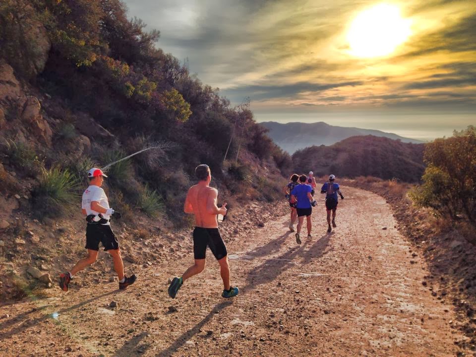
Considered the recreational crown jewel of the Santa Monica Mountains, Malibu Creek State Park has over 8,000 acres of rolling tallgrass plains, oak savannahs and dramatic peaks. Rapid, dramatic geologic changes created the spectacular landscape of Malibu Creek State Park. Its jagged mountains, rock outcroppings, cliff-like slopes and deep gorges were formed over two million years by severe climate changes, earthquakes, erosion and tectonic plate collisions. These forces continue to shape the landscape today. The Malibu Creek State Park is host to the annual Sean O’Brien 50M race.
The Sean O’Brien 50M was created after the original Ray Miller course had suffered a devastating fire in early May. The area was badly burned, and needed time to heal. The race director was inspired to still bring a solid, competitive, and tough 50 mile/50k race to southern California in early winter. She also had a deep desire to still have this sort of race in the beautiful Santa Monica Mountains.
The result was the creation of one of the most epic race courses to date on the West Coast. Personally mapped out and created by her close friend, Sean O’Brien, it only seemed fair to name the race after him. The race course consists of beautiful single-track on the Backbone Trail, miles of sweeping ocean views, and close to 11,000+ feet of gain in the 50-mile distance. The back country trails of the Santa Monica Mountains are breathtaking and some parts rarely touched.
Course highlights
From Malibu Creek State Park Miles 0-7:
Follow the paved road through the campground to Spur trail. This will connect to a paved road (Dorothy Dr.) and turn right on Dorothy Dr(in tapia Park). Follow Dorothy Dr. to a parking lot, and look for a trailhead to the right of the parking lot. Take that trail. The trail will cross a creek and head up on the other side. When you get to a small, cinder block outhouse, turn right on the trail heading up (the trail will be just before and next to the outhouse). Continue heading up. When the trail intersects with the Corral Cyn/Mesa Peak Motorway stay to the left and continue heading up. At the next intersection with another fire road, stay to the right. At the next intersection with a single track trail, take the trail to the right (this is the Backbone Trail). Follow the BBT to the Corral Cyn. parking lot.
Mile 7 – the intersection with the BBT, turn left onto the BBT heading west.
Mile 13.3 – Continue on the BBT as it crosses Latigo Cyn. Rd. to the parking lot on Kanan Rd.
Mile 15.8 – Continue on the BBT and then turn left onto the Zuma Ridge Motorway
Mile 19.2 – Follow the Zuma Ridge Motorway up and over the mountain, past Buzzard's Roost, to the intersection with the Zuma-Edison Motorway
Mile 21.8 – Continue on the Zuma Ridge Motorway all the way down to the parking lot at the bottom of the mountain.
Mile 22.7 – Turn left onto the Ridge Canyon Access trail and then turn right onto Bonsall Dr. (dirt) following it to the parking lot. Your drop bags will be available at this aid station. Head out again on Bonsall Dr (dirt)
Mile 23.2 – Turn right onto the Canyon View trail
Mile 24.5 – Turn left onto the Kanan-Edison fire road
Mile 25.8 – Turn left onto the Zuma Canyon Connector trail
Mile 26.5 – Turn left onto the Zuma-Edison Fire road
Mile 30.4 – Turn right on the Zuma Ridge Motorway
Mile 33.8 Turn right onto the BBT at Kanan Trailhead
Return the exact same way back to Malibu Creek State Park.
评论
Be the first to write a review for this event
赛事信息可以在在赛事的官方网站或通过公开渠道找到。 总是以官方网站上的最新赛事信息作为参考。 如果有任何数据错误或遗失,请通过电子邮件告知我们.