Laugavegur Ultra Marathon


Join Laugavegur Ultra Marathon
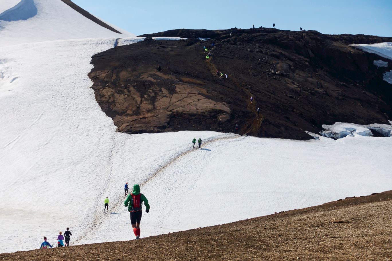
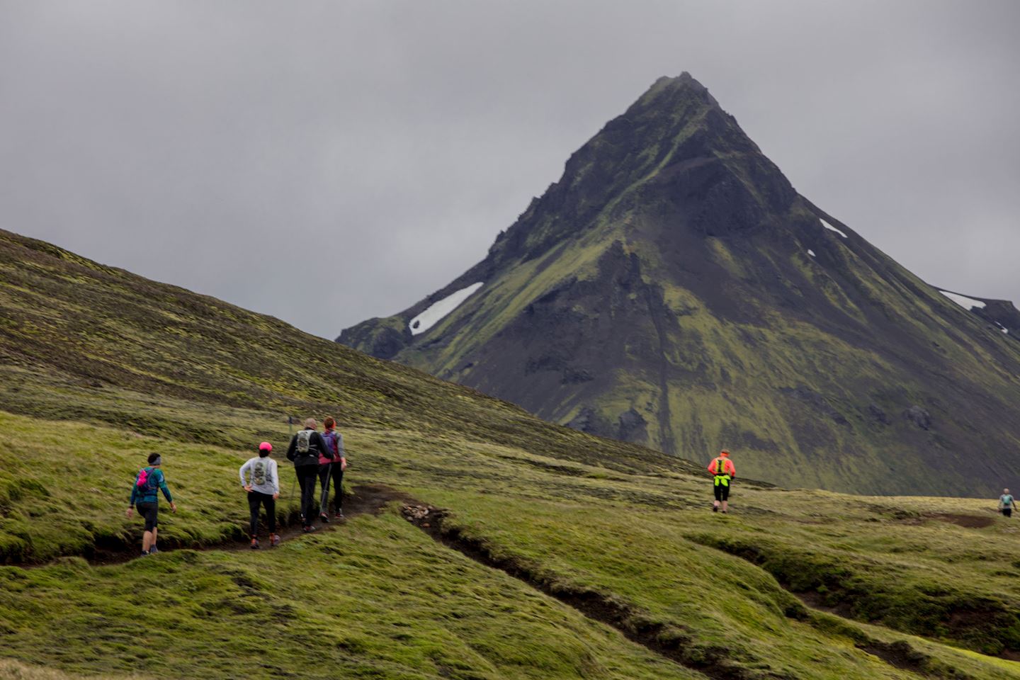
The annual Laugavegur Ultra Marathon will take place in July. The Laugavegur trail is located in the southern highlands of Iceland and connects the nature reserves Landmannalaugar and Thorsmork. For many runners the Laugavegur Ultra Marathon is the most enjoyable race in Iceland. The course is 55 km and takes runners through areas of outstanding natural beauty.
Competitors must be in a very good physical shape to take part in this 55 km Ultra Marathon. If you want to know what kind of race the Laugavegur Ultra Marathon is we recommend that you watch some of the video's of the course. As the videos show the Laugavegur trail is very challenging and takes the runner through areas of outstanding natural beauty.
The course is multi-terrain; sand, gravel, grass, snow, ice, rivers and streams.
The Reykjavik Sports Union is a nonprofit organization that organizes five sport events every year which include Laugavegur Ultra Marathon in July.
Course highlights
The four parts of the course in percentage of the total 55 km.
From Landmannalaugar to Hrafntinnusker 20% +/- 5%
From Hrafntinnusker to Álftavatn 20% +/- 5%
From Álftavatn to Emstrur 30% +/- 5%
From Emstrur to Þórsmörk 30% +/- 5%
The first section of the course is from Landmannalaugar to Hrafntinnusker. The distance as the crow flies is approximately 10km, with an elevation of just under 500m. The scenery is pretty and the terrain gentle, but this is the toughest part of the course as most of it is uphill. Since this section is only one-fifth of the total race course, setting off at a slow pace is advisable. A stretch of snow and ice (about 500m) has to be crossed shortly before Hrafntinnusker is reached. Take extra care when going through areas of geothermal activity. Nearing Hrafntinnusker the path is very steep and most people walk up the hills and jog slowly between them. Many runners make the mistake of attempting this section too fast and expend too much energy running up the hills at speed. First-time competitors are therefore advised to allow 20% of their target time on this section rather than exhausting themselves. Keep in mind that you have 80% of the course still to come and that the race is just beginning. You can expect snow at the beginning of the course – how much varies from year to year.
The second section is from Hrafntinnusker to Álftavatn. The distance as the crow flies is 12km, with a drop in elevation of 500m. This is the highest section of the course so snow and ice can be expected. The terrain from Hrafntinnusker is sand alternating with patches of snow, with the amount of snow varying from year to year, and the course is undulating. After this undulating section, the path climbs until a fairly flat section is reached that passes the highest mountain in the area, Háskerdingur. At this point there is a small sloping geothermal area that runners have to cross. The ground here can be muddy and slippery, and runners should take extra care at every step of the way. Once this area has been traversed there is a spectacular view over the lake at Álftavatn. The path now falls sharply and can be treacherous, so the descent should be taken carefully. Grashagakvísl is the first river on the course, but the stepping-stones make crossing easy.
The third section of the course is from Álftavatn to Emstrur. Before departing from Álftavatn all runners must check in at the marked check point. The distance as the crow flies is 16km, with a drop in elevation of 50m. Long parts of the course are flat but there are several rivers and streams that have to be crossed. Runners will be helped across the largest river, Bláfjallakvísl. Participants can have a change of shoes and/or clothes taken to Bláfjallakvísl, and it is up to the individual to decide whether he/she wishes to take advantage of this possibility. Runners aiming at very fast finishing times generally want to lose as little time as possible, but it is a good idea to have dry shoes and clothes sent on, not to mention energy-giving refreshment, just in case. This part will take approximately 30% of the total race time, although stronger runners will cover the long, flat stretches of sand faster. A long descent to Emstrur ends this section.
The fourth and final section of the course, from Emstrur to Húsadalur in Þórsmörk, is 17km as the crow flies, with a drop in elevation of 300m. At this point runners will reap the benefits of not having started out too fast. During the earlier parts of the race runners should think in terms of conserving energy so that not more than 30% of the total race time is spent on this section, which contains some very challenging hills as well as long stretches of fairly flat land. Soon after Emstrur the course crosses the bridge over the river Fremri-Emstruá, but care should be taken going down the steep path to the bridge. There is a rope, which makes the descent easier. The surroundings are now very diverse and undulating. From the top of the final hill, Kápan, the Þórsmörk valley can be seen. On the other side of Kápan lies the final river that has to be crossed, Þröngá. Take care when wading this river as the water can be up to a meter deep.
For safety reasons there is a rope stretched over the river, which runners should hold onto as they cross. From the river it is about 4km along an undulating woodland path to the finish line at Þórsmörk in Húsadalur.
赛事信息可以在在赛事的官方网站或通过公开渠道找到。 总是以官方网站上的最新赛事信息作为参考。 如果有任何数据错误或遗失,请通过电子邮件告知我们.